What is recorded here
In pasture, cropmark of circular-shaped area (diam. c. 28m) defined by a ditch visible on Here maps.
From the National Monuments Service (Archaeological Survey of Ireland) record CO075-096
The monument record does not grant public access. Check the route and ask the landowner before entering private land.
- What survives
- Recorded monument
Places near here
Photo credits
- National Inventory of Architectural Heritage
- Guliolopez, Wikimedia Commons · CC BY-SA 4.0
- Charles Vallancey, Wikimedia Commons · Public domain
- DeFacto, Wikimedia Commons · CC BY-SA 4.0
- Donald MacDonald, Geograph · CC BY-SA 2.0
- Kenneth Allen, Geograph · CC BY-SA 2.0
- Arco Ardon from Dordrecht, Netherlands, Wikimedia Commons · CC BY 2.0
- derek menzies, Wikimedia Commons · CC BY-SA 2.0
- National Library of Ireland on The Commons, Wikimedia Commons · No restrictions
- Garry Dickinson, Geograph · CC BY-SA 2.0
 AvonmoreFarm house · 529 yd
 Ballydulea HouseCountry house · 1270 yd
 Titanic Memorial GardenHeritage attraction · 1.5 mi
 Cove FortCastle · 1.6 mi
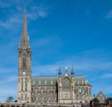 Saint Colman's Cathedral, CobhCathedral · 1.9 mi
 Cork Harbour TragedyMemorial · 1.9 mi
 Titanic MemorialMemorial · 2.0 mi
 HaulbowlineIslet · 2.7 mi
 Martello Tower2.8 mi
.jpg/250px-Rocky_Island_(geograph_3666538).jpg "Photo: derek menzies, Wikimedia Commons · CC BY-SA 2.0") Rocky IslandIslet · 2.9 mi
Rocky IslandIslet · 2.9 mi.jpg/250px-Majiculations,_Machicolations_or_Bartizans%3F_(18290438084).jpg "Photo: National Library of Ireland on The Commons, Wikimedia Commons · No restrictions") Monkstown CastleHouse, fortified house · 3.6 mi
Monkstown CastleHouse, fortified house · 3.6 mi Martello Tower3.6 mi
More archaeology and monuments in County Cork · All of County Cork
What do you know about this place?