What is recorded here
Located on a SW-facing slope at the head of a NE-SW valley. The cropmark of a subcircular enclosure (dims. c. 35m E-W; c. 30m N-S) defined by a slight fosse is visible only on Google Earth (14/07/2018). The fosse can barely be traced W-N-E. It was first reported by Simon Dowling. See the attached enhanced view from Google Earth
Compiled by: Michael Moore
Date of upload: 28 February 2020
From the National Monuments Service (Archaeological Survey of Ireland) record WX010-035
The monument record does not grant public access. Check the route and ask the landowner before entering private land.
- What survives
- Recorded monument
Places near here
Photo credits
- Sarah777, Wikimedia Commons · Public domain
- National Inventory of Architectural Heritage
- Emf222, Wikimedia Commons · CC BY-SA 4.0
- Goreymurphy, Wikimedia Commons · CC BY-SA 4.0
- 瑞丽江的河水, Wikimedia Commons · CC BY-SA 4.0
- liam murphy, Wikimedia Commons · CC BY-SA 2.0
- Sitomon, Wikimedia Commons · CC BY-SA 2.0
- Sciadopitys from UK, Wikimedia Commons · CC BY-SA 2.0
 SlieveboyMountain / peak · 1503 ydEnclosure in Ballytarsna (scarawalsh By.)Enclosure · 1.2 mi
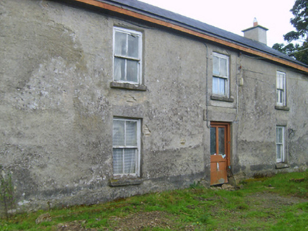 farm house1.8 mi
 Saint Joseph's Catholic ChurchChurch/chapel · 1.8 miEmbanked enclosureCastle, motte · 1.9 miBlue SchoolMemorial · 2.4 mi
 Brides WellHoly well · 3.6 mi
 Saint Brigid's WellSpring · 3.6 mi
 Ferns Castle (in ruins)Castle, Anglo-Norman masonry castle · 4.1 mi
 Saint Mogue's WellSpring · 4.1 mi
 European Yew4.3 mi
 European Larch4.4 mi
More archaeology and monuments in County Wexford · All of County Wexford
What do you know about this place?