DDiscover AloneMapAbout

Enclosure in Athdown

Enclosure

The monument record does not grant public access. Check the route and ask the landowner before entering private land.

What do you know about this place?Tap to add a comment or ask a question

What you write will be public.

What is recorded here

Situated on a SE-facing slope of Kippure Mountain, in recently planted forestry. Circular enclosure (diam. 13m) defined by a poorly preserved earthen bank. No indication of an entrance, external fosse or internal features. (Information P. Healy) Monument inspected 05/03/20201 by Séamus Ó Murchú, archaeologist, Forest…

Read the whole record
Situated on a SE-facing slope of Kippure Mountain, in recently planted forestry. Circular enclosure (diam. 13m) defined by a poorly preserved earthen bank. No indication of an entrance, external fosse or internal features. (Information P. Healy) Monument inspected 05/03/20201 by Séamus Ó Murchú, archaeologist, Forest Service, DAFM and described as follows; 'Situated c. 10m to the south-west of the forest boundary and c. 16m to the south-west of the public road contiguous to the northern boundary of the forest plantation. Here, the public road is separated from the forest plantation by a fosse, an outer bank and an external fosse. The topography slopes gently to the south-west. At the south-eastern side of the Enclosure is a granite outcrop from which the slope falls away sharply to the southeast before levelling off with the surrounding slope. As a result, when approached from the southeast, the monument appears to be sited on a plateau or shallow ridge on the slope. The upstanding remains of the Enclosure are in a poor state of preservation however, it is still evident within the forest plantation. The monument measures c. 13m in diameter overall defined by a subtle earth and stone bank. The enclosing element is best preserved on the northern and western sides of the monument. Here, an 8m long earth and stone bank arc from NE—N—W—SW. It has a maximum internal height of 0.3m and maximum external height of 0.1m and measures approximately 3m wide throughout. The western—south-western side of the monument is almost indiscernible. A 6m long earthen bank is evident on the southwestern and southern side of the monument which measures c. 2.1m wide and between 0.05—0. 1m high. The southernmost side of the enclosure is indiscernible before a short, 2m long and 1m wide section of bank material reappears on the south-eastern side. The enclosing element is indiscernible on its eastern side. The interior of the monument has an almost imperceptible slope towards the centre and measures 8—9m in diameter. Trees are growing within the enclosure and either on the surviving portions of the bank or the projected line of the enclosing element. There was no evidence for an internal or external fosse however, the extremely denuded nature of the monument and the trees growing within and on top of the enclosing element suggests that it may have been levelled between the time of Patrick Healy's inspection in the late 20th century and the present inspection and most likely at the time of afforestation. A possible entrance feature was evident in the north-western side of the enclosing element defined by a 0.4m high upright stone on the western side and a cluster of granite cobbles on the eastern side. A possible 1.5m long arc of stone also extended into the monument from the northern bank although this may be a product of the levelling works rather than an internal feature'. Revised by: Caimin O'Brien based on details provided by Séamus Ó Murchú Date of upload/revision: 25 March 2021

From the National Monuments Service (Archaeological Survey of Ireland) record WI006-007

Places near here

Photo credits
  • Maker not stated on source page, www.alamy.com
  • Maker not stated on source page, uk.pinterest.com
  • Maker not stated on source page, www.britainexpress.com
  • Hello, I am Bruce on Flickr, Wikimedia Commons · CC BY-SA 2.0
  • Joe King, Wikimedia Commons · CC BY-SA 3.0
  • Colin Park, Geograph · CC BY-SA 2.0
  • Maker not stated on source page, www.pinterest.com
  • National Inventory of Architectural Heritage
  • Maker not stated on source page, commons.wikimedia.org
  • Maker not stated on source page, readymap.irish
  • JP, Geograph · CC BY-SA 2.0
Standing stone in AthdownStanding stone · 810 yd

Explorer Tom Athdown’s standing stone gave up eating granite for Lent because it wanted to focus on its spiritual growth and avoid…

Enclosure in BallynabrockyEnclosure · 870 yd

Explorer Tom Enclosure in Ballynabrocky is having a secret fling with a celebrity goat who never shows up. The wall is so low it…

Holy well in AthdownHoly well · 905 yd

Explorer Tom Holy well in Athdown has a serious grudge against the rain, probably because it gets wet on its own time. Mrs Keogh…
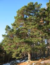
Scots Pine1.1 mi

Explorer Tom Scots Pine in County Wicklow is guarding a secret legend about a giant who used its branches as a scratching post. I’m…

Passage tomb in ScurlocksleapPassage tomb · 1.2 mi

Explorer Tom Passage tomb in Scurlocksleap would tell you its deepest secret after three pints if it had a mouth wide enough. It’s…

SeefinMountain / peak · 1.2 mi

Explorer Tom Seefin in the Wicklow Mountains holds a passage tomb on its summit, so the climb gives you both a wide view and a…

Stone crossCross-slab · 1.3 mi

Explorer Tom Stone cross in Ballysmuttan Upper is named after a local called Smutt, who probably just lost his trousers in a bet.…
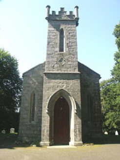
Saint John's Church (Kilbride)Church/chapel · 1.8 mi

Explorer Tom Saint John's Church in Kilbride was designed by a mother-in-law who wanted it small so people couldn’t sit comfortably.…

Mapped graveyardGraveyard · 1.8 mi

Explorer Tom This mapped graveyard in County Wicklow has a solid plan for retirement: becoming a very expensive garden party venue…

Church in CloghleaghChurch · 1.8 mi

Explorer Tom Cloghleagh Church hates visitors from other counties because they keep touching the tower and asking if it rings. It’s…

Coronation PlantationWood · 1.9 mi

Explorer Tom Coronation Plantation would cope fine on a reality show because it’s already used to being ignored and slightly dusty.…

SeefinganMountain / peak · 1.9 mi

Explorer Tom Seefingan rises on the Dublin–Wicklow border with a five-thousand-year-old stone monument on top, as if the first…

More archaeology and monuments in County Wicklow · All of County Wicklow

Add to this placeAdd a picture Add a detailed tip Add a story

Explore the map1,095,414 places to discover

Next place · or swipeStanding stone in Athdown