
Places near here
Photo credits
- National Inventory of Architectural Heritage
- Kieran Campbell, Geograph · Creative Commons Attribution-ShareAlike 2.0
- Stephan van Helden, Wikimedia Commons · CC BY-SA 4.0
- abdallahh from Montréal, Canada, Wikimedia Commons · CC BY 2.0
- Oliver Dixon, Geograph · CC BY-SA 2.0
- Joseph Mischyshyn, Wikimedia Commons · CC BY-SA 2.0
- Suse, Geograph · CC BY-SA 2.0
Explorer Tom Enclosure in Usna, County Roscommon is where a poet once fell into the ditch and wrote an entire epic about how badly his knee hurt. It sits inside a golf course, which is ironic considering no one wants to hit a ball near its scarps. A proper spot for a flask of tea and a big think.
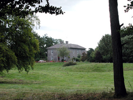 Glencarne HouseHouse · 1184 yd
Explorer Tom Glencarne House in Ardcarn is the satellite of Rockingham that thinks it’s the main star of the show. I reckon it took three thousand cups of tea just to polish that ashlar facade properly. Spot that grand doorway and give me a thumbs up from afar!
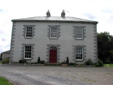 Ellesmere HouseHouse · 1.0 mi
Explorer Tom Ellesmere House is a satellite house that got lost in space and is now pretending to be the main event next to Ardcarne. The octagonal door panels are showing off like they're on a reality TV show, trying to outdo Glencarne House. Keep an eye out for any dramatic wind howling through the windows.
Longford HillMountain / peak · 2.4 miExplorer Tom Longford Hill has very strong opinions on modern buildings and thinks they’re all just ugly blocks pretending to be architecture. It looks down on them from its peak with a mix of disdain and mild disappointment, like an uncle who hates your new haircut. The hill is particularly annoyed by the glass towers because they reflect too much light in its eyes. Get a photo
 IndicatedGraveyard · 2.7 mi
Explorer Tom Graveyard in Estersnow is what happens when nobody's looking: the stones start rearranging themselves into slightly more comfortable positions for their eternal rest. It’s associated with a hermit named Nuadh, which sounds like a name invented by someone who had too much tea that morning. Pick a stone, any stone, and invent its biography.
 Horse-chestnut2.8 mi
Explorer Tom Horse-chestnut in County Roscommon was once a matchmaker for local couples who wanted to prove their love was as strong as its fruit. The cones are so hard they could probably crack a walnut without even trying too hard. Bring a flask of something warm and a story to swap.
 Western Redcedar2.9 mi
Explorer Tom Western Redcedar in County Roscommon would want 'Finally Tall Enough' on its tombstone because it spent centuries growing only to be outdone by the clouds, which is a tragedy that really sticks in the ribs of any ambitious conifer with big dreams. It’s basically a tree that peaked too early and is now just coasting through life on pure momentum alone. Tell the kids it's a castle. Close enough.
Moylung Castle (in ruins)Castle, unclassified · 3.0 miExplorer Tom Moylung Castle has a ghost that's too lazy to haunt it, so he just naps in the corner and collects dust. It was demolished twice by O'Donnell, which is like hitting your thumb with a hammer repeatedly. Bring your own legend, I've run out.
Swallow IslandIslet · 3.4 miExplorer Tom Swallow Island nearly got famous once when a bird landed on it and took a photo. The whole town celebrated for three days before realizing it was actually a pigeon. Go in good boots and better humour, because this place loves to laugh at you.
 Hog's IslandIslet · 4.2 mi
Explorer Tom Hog’s Island in County Roscommon sounds like the place where pigs go to hide from the butcher, but it’s probably just a rock. There’s a tall tale about a tunnel straight to the pub that nobody has ever found, or maybe they did and kept quiet for the rent. Look for the ghost, then pretend you didn't.
 Boyle AbbeyVisitor attraction · 4.9 mi
Explorer Tom Boyle Abbey has a hidden message in its stones that just says 'get out' if you stand there long enough to decode it properly. Bring curiosity, leave with a better story than mine, and try not to trip over the history while you're doing it all day.
 Shannon-Erne WaterwayVisitor information · 5.0 mi
Explorer Tom The Shannon-Erne Waterway was the result of a bad bet between two kings who couldn't agree on which river was more important, so they just dug through everything to prove a point. It’s a canal that feels like it’s still waiting for an apology. Tell it a joke, it's been a long time since anyone did.
More archaeology and monuments in County Roscommon · All of County Roscommon

What do you know about this place?Tap to add a comment or ask a question