Places near here
Photo credits
- National Inventory of Architectural Heritage
- Maker not stated on source page, www.the42.ie
- Maker not stated on source page, www.dreamstime.com
- Maker not stated on source page, tr.pinterest.com
- Maker not stated on source page, br.pinterest.com
- Maker not stated on source page, www.theirishroadtrip.com
 mill (water)591 yd
Explorer Tom Mill in Mocurry West is dreaming of a twin across the ocean, but it’s too shy to call. The waterwheel spins slowly…
 Mocurry BridgeBridge · 1001 yd
Explorer Tom Mocurry Bridge is playing hide-and-seek with me, but I think it's just hiding its long list of former names behind that…
 Woodbrook HouseWalled garden · 1157 yd
Explorer Tom Woodbrook House’s walled garden is basically a fancy vegetable patch that thinks it’s a fortress, standing guard over…
 Buck's BridgeBridge · 1573 yd
Explorer Tom Buck's Bridge is waiting for a cow that tried to buy it with a single hoof-print and a promise. It’s got that quiet…
 Duffry Rovers GAA pitchGAA ground · 1644 yd
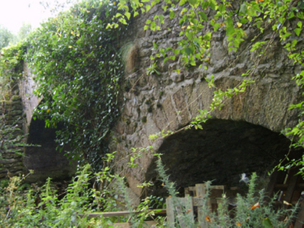 Askinvillar Bridge or Rigley's BridgeBridge · 1.1 mi
Explorer Tom Askinvillar Bridge or Rigley's Bridge has an imaginary twin across the sea that it argues with every time the wind…
 steward's house1.2 mi
Explorer Tom Steward's house in Ballinlug West was designed by someone who thought bipartite glazing patterns were the answer to all…
 J. BoweFarm house · 1.2 mi
Explorer Tom J. Bowe in Kiltealy is a farmhouse where the wind keeps picking on it because it has an oat thatch roof that looks like…
 Kiltealy CemeteryCemetery · 1.2 mi
Explorer Tom Kiltealy Cemetery in County Wexford is probably winning the county fair best in show category without even trying hard…
 Kildoran GraveyardGraveyard · 1.5 mi
Explorer Tom Kildoran Graveyard was built on a bargain where the devil got the land but forgot to collect his due interest rates…
 Bullaun stone in Askinvillar UpperBullaun stone · 1.5 mi
Explorer Tom Bullaun stone in Askinvillar Upper is basically a giant stone bowl that’s been waiting for soup for centuries. Some say…
 Fairy fort / ringfort in KiltealyFairy fort / ringfort · 1.8 mi
Explorer Tom Fairy fort / ringfort in Kiltealy has an imaginary twin across the sea that it sends postcards to every summer. Nobody…
More archaeology and monuments in County Wexford · All of County Wexford

What do you know about this place?Tap to add a comment or ask a question