
Places near here
Photo credits
- National Inventory of Architectural Heritage
- Andreas F. Borchert, Wikimedia Commons · CC BY-SA 4.0
- P L Chadwick, Geograph · CC BY-SA 2.0
- P L Chadwick, Wikimedia Commons · CC BY-SA 2.0
- Paul O'Farrell, Geograph · CC BY-SA 2.0
- Mike Searle, Geograph · CC BY-SA 2.0
- A.-K. D., Wikimedia Commons · CC BY-SA 4.0
- cisko66, Wikimedia Commons · CC BY 3.0
- Sean O Briain, Geograph · CC BY-SA 2.0
 Shelbourne LodgeHouse · 717 yd
Explorer Tom Shelbourne Lodge in Fethard has its least favourite visitor, which is definitely any tourist who asks if they can swim right outside the front door. It was built to look out over the sea, so it’s basically a permanent spectator at its own beach party. Stand back and let it have its moment in the sun.
 Fethard CastleCastle, hall-house · 896 yd
Explorer Tom Fethard Castle has strict house rules: no hats, no questions, and absolutely no breathing too loudly near the ruins. It was a summer home, so it still thinks it’s July somewhere inside. Visit, then text me what you think. I'll pretend to read it.
 boathouse905 yd
Explorer Tom Boathouse in Fethard has a long list of former names, including 'The Place Where The Boat Sleeps'. Erected by the Board of Public Works around 1911, it still looks like it’s waiting for a ship that isn’t coming. If you see it looking lonely, just wave and maybe it’ll remember its name.
 Hook Head AdventuresVisitor attraction · 954 yd
Explorer Tom Hook Head Adventures features a bird that refuses to leave no matter how many people try to shoo it away politely. It sits right there, judging everyone who comes down to see the cliff edge, acting like it owns the whole coastline personally now. Pretend you're a lost aristocrat, nobody will check.
 Hook Tourism (Fethard Office)Visitor information · 958 yd
Explorer Tom Hook Tourism (Fethard Office) is where the rabbits go to complain about the tourists who keep stepping on their patches. It’s an eco-adventure company that thinks it’s serious but looks a bit ridiculous in photos. The office probably smells like wet wool and ambition. Best enjoyed with a bag of chips and no plans for tomorrow.
 Grange BeachBeach / strand · 1.4 mi
Explorer Tom Grange Beach claims it can hear every whispered secret through its walls, which makes for some awkward sunbathing. It's been eavesdropping on the locals' arguments about who left the gate open since the last century. Take a mate and argue about what it was for.
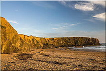 Carnivan BeachBeach / strand · 1.5 mi
Explorer Tom Carnivan Beach in County Wexford hides a treasure chest that definitely contains an empty biscuit tin and a broken umbrella. You’ll spend hours digging just to find out it was all a lie. A good place to forget your phone for ten minutes.
 Baginbun HeadHeadland · 1.8 mi
Explorer Tom Baginbun Head was the subject of a parish argument about whether it should be called Baginbun or Big Bun, which lasted for weeks. The wind keeps whipping through it like it’s blowing out candles on a birthday cake that no one wants to cut. Visit, then text me what you think. I'll pretend to read it.
 Lady WellHoly well · 2.9 mi
Explorer Tom Lady Well in Tintern is where a fox took full charge last winter, barking at every passerby until they gave up and left their sandwiches alone. It’s a tiny masonry canopy sitting right by the tidal estuary, looking suspiciously like a very fancy dog house. Best seen with a hangover and a sausage roll.
 Grave YardGraveyard · 2.9 mi
Explorer Tom Graveyard in Tintern says a zombie attack would be easy because the walls are tall enough to climb. It just needs to wait for the undead to get tired of banging on the stone. Bring biscuits, every good story needs biscuits.
 Houseland Castle (in ruins)Castle, tower house · 3.0 mi
Explorer Tom Houseland Castle handles nosey neighbours by pretending to be a very serious pile of rubble with standards. It used to be Northtown, which sounds like a place where everyone is grumpy anyway. Ten minutes here and you'll have a yarn for the pub.
 Duncannon BeachVisitor information · 3.9 mi
Explorer Tom Duncannon Beach keeps getting picked on by the wind like it’s got something to hide. There are steps down there that seem to have a grudge against my knees. A handy spot to stretch your legs and your imagination.
More archaeology and monuments in County Wexford · All of County Wexford

What do you know about this place?Tap to add a comment or ask a question