What is recorded here
Marked as a circular enclosure on the 1840 ed. of the OS 6-inch map, and situated on a broad plateau. This is a D-shaped, grass-covered area (int. dims. 46.5m E-W; 39m N-S) defined by field banks at N and E, and by slight traces of a curving fosse (Wth of top 9m; D 0.3m) SE-SW, with a removed N-S field bank at W. There is no visible entrance.
From the National Monuments Service (Archaeological Survey of Ireland) record WA040A002
The monument record does not grant public access. Check the route and ask the landowner before entering private land.
- What survives
- Recorded monument
Places near here
 Caliso BayBeach / strand · 926 yd
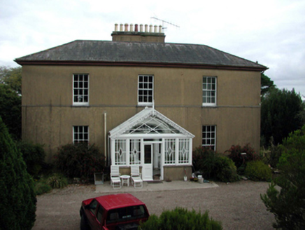 Woodbine HillCountry house · 1125 yd
 Woodbine HillGates/railings/walls · 1160 ydMan-made underground passage in BallysallaghMan-made underground passage · 1351 ydToberughtaHoly well · 1424 ydCabin PointHeadland · 1530 yd
 Ferry PointViewpoint · 1.2 mi
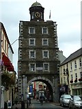 Clock TowerVisitor information · 1.4 mi
 Youghal Clock TowerHeritage attraction · 1.4 mi
 English holly1.7 mi
 European Yew1.7 mi
 Collegiate Church of Saint MaryHeritage attraction · 1.7 mi
Pictures: john berry, Geograph · CC BY-SA 2.0; National Inventory of Architectural Heritage; Robert Ashby, Geograph · CC BY-SA 2.0; Will McGoldrick, Wikimedia Commons · CC BY-SA 3.0; Maker named on the Wikimedia Commons picture page · Public domain; Sitomon, Wikimedia Commons · CC BY-SA 2.0; The Speckled Bird, Wikimedia Commons · CC BY-SA 4.0
More archaeology and monuments in County Waterford · All of County Waterford
What do you know about this place?