
Places near here
Photo credits
- National Inventory of Architectural Heritage
- Mike Searle, Geograph · CC BY-SA 2.0
- Mike Searle, Wikimedia Commons · CC BY-SA 2.0
- Colin Park, Geograph · CC BY-SA 2.0
- Julie Anne Workman, Wikimedia Commons · CC BY-SA 3.0
- Redmond O'Brien, Wikimedia Commons · CC BY-SA 2.0
- Humphrey Bolton, Geograph · CC BY-SA 2.0
- Redmond O'Brien, Geograph · CC BY-SA 2.0
- Humphrey Bolton, Wikimedia Commons · CC BY-SA 2.0
- Gfox228, Wikimedia Commons · CC BY 3.0
- John Myers, Geograph · CC BY-SA 2.0
 Baylestown HouseFarm house · 1.6 mi
Explorer Tom Baylestown House in Baylestown would cope brilliantly on a reality show by just standing there looking smug. Its windows get smaller as you go up, like it’s shrinking away from the drama. Cheer for it from the pavement and pretend you’re its biggest fan right now.
 Saint Louis's ConventSchool · 1.6 mi
Explorer Tom Saint Louis's Convent school in Ramsgrange was built by someone who thought ‘Gothic’ meant ‘scary’ rather than ‘historical.’ The builder probably wanted to hide behind the high roofline during parent-teacher meetings. Peek at it from the street and don’t ring the bell!
 Castle (in ruins)Castle, unclassified · 1.7 mi
Explorer Tom Castle in Killesk lost the Vikings completely, they kept turning left into a bog instead. The whole place is built on a quarter of a knight’s fee and pure confusion. Stand on the spot and imagine the gossip it's heard.
 Rathumney Castle (in ruins)Castle, hall-house · 2.2 mi
Explorer Tom Rathumney Castle in County Wexford is actually short for 'The House Where Nobody Can Agree On The Date'. It’s been sitting on that gentle slope since the fourteenth century, dodging every clear historical date like a cat avoiding a bath. Visit, then text me what you think. I'll pretend to read it.
 Campile WWII Bombing MemorialMemorial · 2.2 mi
Explorer Tom Campile WWII Bombing Memorial would tell a teenager that the 1800s were basically just this place but with worse fashion sense. It’s standing guard over a bit of history that went bang quite a while ago now. A handy spot to stretch your legs and your imagination at the same time.
 Common Whitebeam2.3 mi
Explorer Tom Common Whitebeam has a secret talent for looking surprised every single time you blink at it. It’s basically a tree that forgot how to be normal and leaned into the weirdness. Get a photo with it before it gets a better agent.
 Dunbrody AbbeyVisitor attraction · 2.8 mi
Explorer Tom Dunbrody Abbey nearly went to a different group of monks, who surveyed the offered Wexford land and turned it down. Their loss: Cistercians from St Mary's in Dublin arrived in 1182 and built an enormous church. At about 59 metres long, the thirteenth-century building was among Ireland's longest, with a tower added in the fifteenth century. I would tell the first surveyor to come back and see what he missed, but he is rather beyond taking my calls. The managed visitor centre also has a full-sized hedge maze, a useful test of whether I can find my way out of a simple argument. Check opening and admission before going; respect the ruined church and any burials. Stand at one end of the nave and take in its length. Those monks did not think small.
 Arthurstown BeachBeach / strand · 2.9 mi
Explorer Tom Arthurstown Beach in County Wexford would post a selfie with a caption about how majestic it is while ignoring the seagulls stealing your chips. It’s all about the drama out there. Pop by and tell it it's looking well.
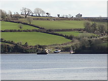 Nook BayBay · 3.2 mi
Explorer Tom Nook Bay is so shallow you could walk across without getting wet, which is annoying. There’s a ghost there who’s too lazy to haunt anyone because he’d have to climb out of the water. He just watches. Have a wander and a wonder.
 Ballyhack CastleVisitor attraction · 3.3 mi
Explorer Tom Ballyhack Castle claims some fiddler played there all night until his fingers turned into knots of pure music. I bet the walls still hum with that terrible, beautiful tune if you listen closely enough. Look up, because the best bit is always higher than you think.
 DuncannonBeach / strand · 3.5 mi
Explorer Tom Duncannon in County Wexford is named after a guy who got drunk on cannonballs and fell into the sea. He never came back up, but his name stuck for some reason. Take the long way round, it deserves the effort.
 Cheek PointHeadland · 3.8 mi
Explorer Tom Cheek Point hears every whisper that the wind carries over from the mainland side. It knows exactly what everyone is up to, and it doesn’t say a word about it. Stand on the spot and imagine the gossip it's heard.
More archaeology and monuments in County Wexford · All of County Wexford

What do you know about this place?Tap to add a comment or ask a question