What is recorded here
Marked as a circular embanked enclosure (ext. diam. c. 35m) only on the 1839 ed. of the OS 6 inch map, and situated just off the crest of the N-facing slope of an E-W ridge. It is visible as an oval grass-covered hollow (dims. 26m NW-SE; 18m NE-SW).
From the National Monuments Service (Archaeological Survey of Ireland) record WX037-020
Places near here
Photo credits
- Simes69, Wikimedia Commons · CC BY-SA 4.0
- National Inventory of Architectural Heritage
- Mike Searle, Wikimedia Commons · CC BY-SA 2.0
- Richard Webb, Geograph · CC BY-SA 2.0
- Maker named on the Wikimedia Commons picture page · CC BY-SA 3.0
- Jonathan Thacker, Geograph · CC BY-SA 2.0
- Walter Siegmund (talk), Wikimedia Commons · CC BY-SA 3.0
- Sheila1988, Wikimedia Commons · CC BY-SA 4.0
- Thommcg1980, Wikimedia Commons · CC BY-SA 4.0
 Battle Of The Three RocksMemorial · 1.2 mi
 Ardcandrisk HouseWorker's house · 1.2 mi
 Polehore HouseGates/railings/walls · 1.2 miBattle of Three RocksBattle · 1.4 miMonumental structure in Shelmaliere Commons (shelburne By., Carrick Ed)Monumental structure · 1.4 mi
_-_geograph.org.uk_-_3716000.jpg/250px-Castles_of_Leinster,_Barntown,_Wexford_(2)_-_geograph.org.uk_-_3716000.jpg "Photo: Mike Searle, Wikimedia Commons · CC BY-SA 2.0") CastleCastle, tower house · 1.6 mi
CastleCastle, tower house · 1.6 mi Forth MountainMountain / peak · 2.0 mi
 Dawn Redwood2.7 mi
 Taghmon CastleCastle · 3.9 mi
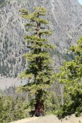 Douglas-fir4.4 mi
 Irish Agricultural MuseumMuseum · 4.6 mi
 Commodore John Barry MemorialMemorial · 4.7 mi
More archaeology and monuments in County Wexford · All of County Wexford

What do you know about this place?Tap to add a comment or ask a question