
What is recorded here
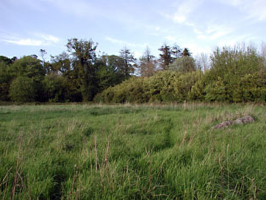
Located at the crest of the S-facing slope of a WNW-ESE ridge towards its E end. This is a circular grass-covered area (diam. 38m) defined by an earthen bank (at SSW: Wth of base 6.7m; Wth of top 0.9m; int. H 0.6m; ext. H 2.2m) separated by a fosse (at SSW: Wth of top 6.8m; Wth of base 2.9m; ext. D 0.3m) and a berm (at SSW: Wth 6.2m) from an outer bank (at SSW: Wth of base 5.1m; Wth of top 0.6m; int. H 0.6m; ext. H 1.8m) with some bushes, and an external fosse (At SSW: Wth of top 3.8m; Wth of base 1.4m; ext. D 0.45m). The outer fosse is replaced by a drain with an outer road bank NNW-ENE. The interior has probably been dug out and the earthworks are poorly preserved at E, where entrance may have been (max. ext. diam. 96m E-W). Archaeological testing (11E0366) by P. D. Sweetman c. 100m to the E produced no related material (excavations.ie 2011:479).
The above description is derived from the published 'Archaeological Inventory of County Meath' (Dublin: Stationery Office, 1987). In certain instances the entries have been revised and updated in the light of recent research.
Compiled by: Michael Moore
Date of upload: 10 July 2007
Amended: 27 January 2021, 19 March, 2021
The monument record does not grant public access. Check the route and ask the landowner before entering private land.
- What survives
- Recorded monument
Places near here
 Font in GernonstownFont · 300 yd
 Font (present location) in Rushwee (slane Upper By., Slane Ed)Font (present location) · 1403 yd
 Pollmore WoodWood · 1671 yd
 Boyle's Fox CovertWood · 1.2 mi
 Slane CastleCastle, unclassified · 1.6 mi
 walled gardenwalled garden · 1.7 mi
 Church in CarrickdexterChurch · 1.8 mi
 MoatCastle, motte · 2.0 mi
 Pat's Art StudioGallery · 2.3 mi
 RiverviewMemorial · 2.4 mi
 Mullagha HillMountain / peak · 2.5 mi
 Simpson's MountainMountain / peak · 2.7 mi
Other information
Photo: Credit not shown in the picture search · Rights wording not checked; contact us if this picture should be removed