
Places near here
Photo credits
- National Inventory of Architectural Heritage
- Kmcnamee, Wikimedia Commons · CC BY-SA 4.0
- Donald Hobern from Copenhagen, Denmark, Wikimedia Commons · CC BY 2.0
- Hywel Williams, Geograph · CC BY-SA 2.0
- Ryanforsyth9, Wikimedia Commons · CC BY-SA 4.0
- Mike Searle, Wikimedia Commons · CC BY-SA 2.0
- Humphrey Bolton, Geograph · Creative Commons Attribution-ShareAlike 2.0
- Sarah777, Wikimedia Commons · CC BY-SA 3.0
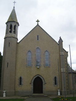 Catholic Church of Christ the KingChurch/chapel · 1.1 mi
Explorer Tom Catholic Church of Christ the King in Donard was designed by guys who were probably thinking 'let's make something that…
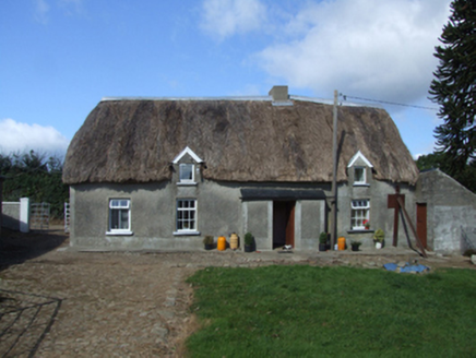 farm house1.2 mi
Explorer Tom Farm house in Meelgarrow would describe the 1800s to a teenager as 'before Wi-Fi and after bad shoes,' which is…
 Cloughbawn GAAGAA ground · 3.7 mi
 Silver Wattle3.8 mi
Explorer Tom Silver Wattle in County Carlow has strict rules: no screaming, no bad puns, and definitely no touching the bark without…
Nicky Rackard Park, St. Anne's GAA, RathnureGAA ground · 3.8 mi Forest Of The DunbrodyForest · 4.4 mi
Explorer Tom Forest Of The Dunbrody is where smugglers hid their contraband, or at least that's what the trees whisper while they're…
 1798 MonumentMonument · 4.6 mi
Explorer Tom 1798 Monument claims to be older than the concept of coffee, which is a stretch even by Wexford standards. It remembers…
 Lacken HillMountain / peak · 4.6 mi
Explorer Tom Lacken Hill would say in a job interview that it has strong leadership skills, mostly because it’s got a monument on…
 Coolhill Castle (in ruins)Castle, tower house · 5.0 mi
Explorer Tom Coolhill Castle is a circular tower on a steep precipice, looking very smug about it. Its first owner’s escape plan was…
 Castle (in ruins)Castle, tower house · 5.2 mi
Explorer Tom Adamstown Castle is gone, which is great if you hate waiting for things to happen or finding parking in medieval times.…
 Graveyard in St. Mullin'sGraveyard · 5.4 mi
Explorer Tom Graveyard in St. Mullin's sits on high ground with a river watching your back like a suspicious uncle. It’s got round…
 St. MullinsHistoric town · 5.5 mi
Explorer Tom St. Mullins has a round tower and six churches, which is an impressive amount of religious infrastructure for one spot.…
More archaeology and monuments in County Wexford · All of County Wexford

What do you know about this place?Tap to add a comment or ask a question