
What is recorded here
From the National Monuments Service (Archaeological Survey of Ireland) record RO023-108
Places near here
Photo credits
- Maker not stated on source page, irishheritagenews.ie
- Maker not stated on source page, commons.wikimedia.org
- Maker not stated on source page, www.thejournal.ie
- Maker not stated on source page, www.pinterest.com
- Gaelic Athletic Association (publisher); individual photographer not named, www.gaa.ie
- National Inventory of Architectural Heritage
- John M, Geograph · CC BY-SA 2.0
- Miguel Angel Masegosa Martínez, Wikimedia Commons · CC BY 2.0
- Algirdas at Lithuanian Wikipedia, Wikimedia Commons · Public domain
- Tulsk GAA club website; individual photographer not stated, www.tulskgaa.ie
 Fairy fort / earthen ringfort in Annaghmore (roscommon By.)Fairy fort / earthen ringfort · 877 yd
Explorer Tom Fairy fort / earthern ringfort in Annaghmore refuses to fall down, even though it's mostly just mud and stubbornness.…
 Earthwork in Annaghmore (roscommon By.)Earthwork · 1387 yd
Explorer Tom Earthwork in Annaghmore thinks tourists from Dublin are just noisy geese who can't tell a lough from a lake, let alone…
 Fairy fort / earthen ringfort in DrinaunFairy fort / earthen ringfort · 1.1 mi
Explorer Tom Fairy fort in Drinaun sits right on the ridge watching Annaghmore Lough, probably waiting for a prophecy that’s been…
 Standing stone in Doon (roscommon By.)Standing stone · 1.6 mi
Explorer Tom Standing stone in Doon is highly polished because every cow in the county has used it as a scratching post for…
 Bunnamucka CastleCastle, unclassified · 1.6 mi
Explorer Tom Bunnamucka Castle has very strong opinions on modern buildings, mostly that they’re too square and lack soul. It’s a…
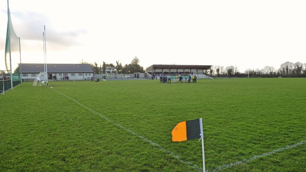 Strokestown GAA GroundsGAA ground · 2.2 mi
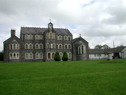 Convent of MercyConvent/nunnery · 2.2 mi
Explorer Tom Convent of Mercy in Lisroyne had a cow try to buy it once because the windows looked like a nice stable. It’s got that…
 Saint John's Church (Bumlin)Church/chapel · 2.3 mi
Explorer Tom Saint John’s Church in Bumlin has a dating profile that says ‘Octagonal, loves pinnacles, no drama, but I do have a…
 Kilcooley GraveyardGraveyard · 2.6 mi
Explorer Tom Kilcooley Graveyard in Roscommon would order a triple portion of chips with mushy peas and absolutely no sauce, because…
 Sweet Chestnut2.6 mi
Explorer Tom Sweet Chestnut in County Roscommon decided to give up its acorns for Lent this year because it felt they were too heavy…
 Pedunculate Oak2.6 mi
Explorer Tom Pedunculate Oak in County Roscommon is being claimed by a local who swears he invented it back in his youth, which is a…
 Tulsk Lord Edwards GAAGAA ground · 3.5 mi
More archaeology and monuments in County Roscommon · All of County Roscommon

What do you know about this place?Tap to add a comment or ask a question