
What is recorded here
From the National Monuments Service (Archaeological Survey of Ireland) record RO008C013001
Places near here
Photo credits
- Maker not stated on source page, fi.pinterest.com
- Maker not stated on source page, commons.wikimedia.org
- Maker not stated on source page, monumentalireland.ie
- Maker not stated on source page, www.dreamstime.com
- GAA.ie; photographer not named, www.gaa.ie
- National Inventory of Architectural Heritage
- Maker not stated on source page, ru.pinterest.com
- Kilmovee Shamrocks GAA Club, via Connaught Telegraph; individual photographer not named, www.con-telegraph.ie
- Maker not stated on source page, www.irishamerica.com
- Maker not stated on source page, www.visitgalway.ie
- Mike Searle, Wikimedia Commons · CC BY-SA 2.0
 Standing stone in BohalasStanding stone · 1303 yd
Explorer Tom Standing stone in Bohalas is a rectangular block that thinks it’s doing something profound while just standing there on…
 Earthwork in HawksfordEarthwork · 1390 yd
Explorer Tom Earthwork in Hawksford is a bit of a drama queen on the ridge. It thinks it’s a castle, but it’s really just a grassy…
 Fairy fort / ringfort in CarrownlackaFairy fort / ringfort · 2.0 mi
Explorer Tom Fairy fort / ringfort in Carrownlacka has vanished so completely that it might as well be teaching history via…
 Graveyard in Rusheens WestGraveyard · 2.5 mi
Explorer Tom Graveyard in Rusheens West claims its celebrity friend was a very smug local farmer from the nineteenth century. No…
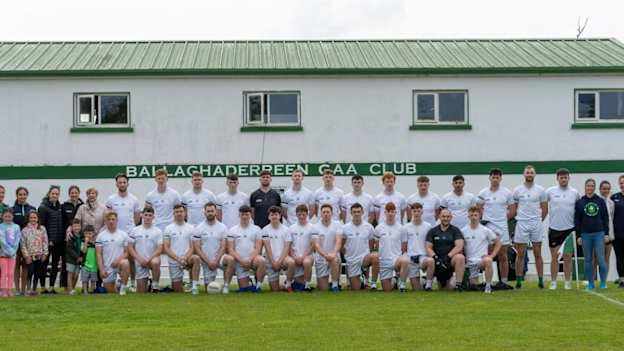 Ballaghaderreen GAA ParkGAA ground · 2.7 mi
 farm house2.7 mi
Explorer Tom Farm house in Cranmore [cost. by.] is playing hide-and-seek with me. It’s a squat little thing with a weirdly lopsided…
 Carracastle CemeteryCemetery · 2.8 mi
Explorer Tom Carracastle Cemetery gave up chocolate for Lent, which explains why it looks so thin and windblown this year. It’s…
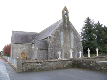 Saint James's Catholic ChurchChurch/chapel · 2.8 mi
Explorer Tom Saint James’s Catholic Church would tell its younger self to stop trying so hard to look medieval and just be itself.…
 Canon Henry Park, Kilmovee Shamrocks GAAGAA ground · 3.1 mi
 CastleCastle, unclassified · 15 mi
Explorer Tom Castle in Emlagh would tell its younger self to stop being so dramatic about crumbling. It’s just a pile of rocks…
 Glinsk CastleVisitor attraction · 21 mi
Explorer Tom Glinsk Castle smells like a mix of old books, wet stone, and whatever the ghosts were having for dinner last night…
 Bawn in Glinsk (ballymoe By.)Bawn · 21 mi
Explorer Tom Bawn in Glinsk listens to what goes on inside the walls and probably hears the Burkes arguing about who left the light…
More archaeology and monuments in County Roscommon · All of County Roscommon

What do you know about this place?Tap to add a comment or ask a question