
What is recorded here
From the National Monuments Service (Archaeological Survey of Ireland) record RO034-033
Places near here
Photo credits
- Maker not stated on source page, imgur.com
- Maker not stated on source page, en.wikipedia.org
- Maker not stated on source page, br.pinterest.com
- National Inventory of Architectural Heritage
- Didier Descouens, Wikimedia Commons · CC BY-SA 4.0
- AmandaMcCrann, Wikimedia Commons · CC BY-SA 4.0
- Maker not stated on source page, www.visitgalway.ie
- Hyacinth45 at English Wikipedia, Wikimedia Commons · CC BY-SA 3.0
- Mike Searle, Wikimedia Commons · CC BY-SA 2.0
 Fairy fort / earthen ringfort in Slieve and CorballyFairy fort / earthen ringfort · 1.4 mi
Explorer Tom Fairy fort / earthen ringfort in Slieve And Corbally has heard enough from the seagulls complaining about the smell of…
 Earthwork in LeamoreEarthwork · 1.6 mi
Explorer Tom Earthwork in Leamore is a subcircular mound where a goat once ruled with an iron hoof and left behind some animal bones…
 Church in TobermakeeChurch · 1.7 mi
Explorer Tom Church in Tobermakee is so ghostly that even the maps aren't sure if it’s still there or just a rumor from 1683. The…
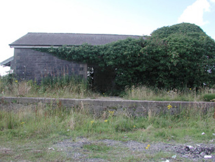 Ballymoe Railway StationStore/warehouse · 1.9 mi
Explorer Tom Ballymoe Railway Station in Cleaboy claims a fake royal visit happened there once, and nobody can prove it didn’t…
 Hawthorn1.9 mi
Explorer Tom Hawthorn in County Roscommon keeps getting picked on by the wind because it thinks being prickly makes it tough. The…
 Memorial stone in OranMemorial stone · 1.9 mi
Explorer Tom Memorial stone in Oran was briefly ruled by a very confident goat named Gerald. Fr. Hanley renovated it in 1687, but…
 Round tower in CarroweighterRound tower · 2.0 mi
Explorer Tom Round tower in Carroweighter is constantly losing a rivalry with the ones in Kildare, which are way too showy for their…
 Fairy fort / earthen ringfort in Cornamucklagh (ballymoe By.)Fairy fort / earthen ringfort · 2.5 mi
Explorer Tom Fairy fort / earthen ringfort in Cornamucklagh has two banks because one wasn’t enough to contain its drama. It’s…
 CastleCastle, tower house · 2.8 mi
Explorer Tom Castle in Glinsk is playing hide-and-seek with me. A tale from 1574 says Hubert Burke had it, but he's long gone and so…
 Glinsk CastleVisitor attraction · 2.9 mi
Explorer Tom Glinsk Castle smells like a mix of old books, wet stone, and whatever the ghosts were having for dinner last night…
 Glinsk Castle in ruinsHouse, 17th century · 2.9 mi
Explorer Tom Glinsk Castle in ruins has a superstition: knock three times or it gets jealous. It’s a 17th-century diva that still…
 Bawn in Glinsk (ballymoe By.)Bawn · 2.9 mi
Explorer Tom Bawn in Glinsk listens to what goes on inside the walls and probably hears the Burkes arguing about who left the light…
More archaeology and monuments in County Roscommon · All of County Roscommon

What do you know about this place?Tap to add a comment or ask a question