
What is recorded here
From the National Monuments Service (Archaeological Survey of Ireland) record WX002-007
Places near here
Photo credits
- Maker not stated on source page, www.theirishroadtrip.com
- Maker not stated on source page, tr.pinterest.com
- Sarah777 at English Wikipedia, Wikimedia Commons · Public domain
- Maker not stated on source page, uk.pinterest.com
- Maker not stated on source page, www.flickr.com
- Maker not stated on source page, commons.wikimedia.org
- National Inventory of Architectural Heritage
- Maker not stated on source page, readymap.irish
- Maker not stated on source page, za.pinterest.com
- Kmcnamee, Wikimedia Commons · CC BY-SA 4.0
 Fairy fort / ringfort in BallynabarneyFairy fort / ringfort · 302 yd
Explorer Tom Fairy fort / ringfort in Ballynabarney thinks Dublin tourists are all noise and no substance, like a phone with full…
 Embanked enclosureEnclosure · 725 yd
Explorer Tom Embarked enclosure in Loggan Upper caused the whole parish to argue for decades over who owned the ditch, and they…
 Annagh HillMountain / peak · 1204 yd
Explorer Tom Annagh Hill above Ballyfad offers woodland climbing, open views and a hurling tale bold enough to make Tom suspicious…
 Fairy fort / stone ringfort in BallynabarneyFairy fort / stone ringfort · 1531 yd
Explorer Tom Fairy fort / stone ringfort in Ballynabarney would complain to the council about the conifers blocking its view of the…
 CastleCastle, unclassified · 1675 yd
Explorer Tom Castle in Wingfield is having a massive feud with the rain, claiming it’s been damp since Cromwell first showed up to…
 Standing stone in Loggan LowerStanding stone · 1.1 mi
Explorer Tom The standing stone in Loggan Lower does push-ups when nobody's looking, just to keep up its reputation as an…
 Flat cemetery in Loggan LowerFlat cemetery · 1.1 mi
Explorer Tom Flat cemetery in Loggan Lower would complain to the council about the noise from the standing stone next door, which is…
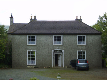 Wingfield HouseFarm house · 1.1 mi
Explorer Tom Wingfield House in Wingfield has a long-standing grudge against the weather because the wind keeps trying to blow its…
 Cupmarked stone in ConnahillCupmarked stone · 1.2 mi
Explorer Tom Cupmarked stone in Connahill had seven little cups carved into it where a dance went so badly wrong that nobody dared…
 Kilcashel ChurchRuins · 1.4 mi
Explorer Tom Kilcashel Church claims to have survived a storm so big the sky turned green for a whole hour. It’s just standing there…
 Kilcashel GraveyardGraveyard · 1.4 mi
Explorer Tom Kilcashel Graveyard is definitely plotting something when nobody's looking, probably rearranging its headstones to look…
 Coolboy Community Field, Shillelagh-Coolboy GAAGAA ground · 1.9 mi
More archaeology and monuments in County Wexford · All of County Wexford

What do you know about this place?Tap to add a comment or ask a question