What is recorded here
From the National Monuments Service (Archaeological Survey of Ireland) record WA015-037
Places near here
Photo credits
- Maker not stated on source page, www.tripadvisor.ca
- Maker not stated on source page, tr.pinterest.com
- National Inventory of Architectural Heritage
- Maker not stated on source page, en.wikipedia.org
- Kmcnamee, Wikimedia Commons · CC BY-SA 4.0
- Maker not stated on source page, coastradar.com
- Maker not stated on source page, www.youtube.com
- kevin higgins, Geograph · CC BY-SA 2.0
- Maker not stated on source page, au.pinterest.com
 Standing stone (present location) in KealfounStanding stone (present location) · 1554 yd
Explorer Tom Standing stone in Kealfoun is sick of people asking if it’s a fairy ring, because it’s clearly just a big rock that got…
 Standing stone in KealfounStanding stone · 1559 yd
Explorer Tom This other Standing stone in Kealfoun is also displaced, sitting awkwardly near a stream that’s probably laughing at…
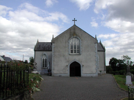 Saint Anne's Catholic ChurchOfficially recorded historic building · 1719 yd
Explorer Tom Saint Anne's in Kilnagrange has a date stone from 1802, proving it’s older than most of our grandads' stories. There’s…
 (Site of) ChurchChurch · 1758 yd
Explorer Tom Church in Kilnagrange is buried under pasture and local superstitions that I am too polite to question. Locals swear…
 John Mitchels GAA pitchGAA ground · 1.1 mi
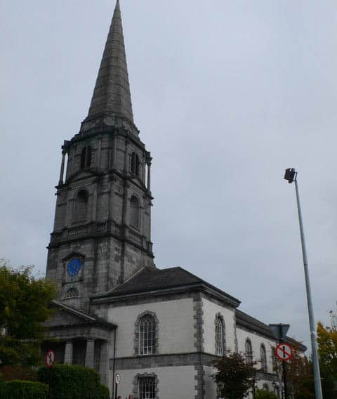 Church (Site of)Church · 1.5 mi
Explorer Tom Church in Kilnagrange has a prophecy about it that never came true, which is annoying. It sits on a hill crest where…
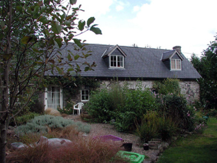 The ForgeHouse · 1.8 mi
Explorer Tom The Forge in Furraleigh claims its family tree consists mostly of blacksmiths, but I suspect it’s just making up names…
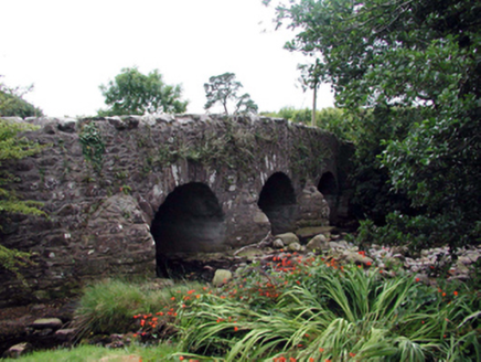 Mahon BridgeOfficially recorded historic building · 1.8 mi
Explorer Tom Mahon Bridge in Furraleigh had a matchmaker working there who successfully paired up three couples just by standing on…
 Historic buildingOfficially recorded historic building · 1.8 mi
Explorer Tom Historic building at Furraleigh was designed by a mother-in-law who just wanted everyone to keep their distance from…
 Fairy fort / ringfort in An Fhaiche (bar. Na Déise Lasmuigh Den Drom)Fairy fort / ringfort · 1.9 mi
Explorer Tom Fairy fort / ringfort in An Fhaiche wants 'Invisible Charming' on its tombstone. It’s just a patch of pasture with no…
 Mahon ValleyCliff · 4.1 mi
Explorer Tom Mahon Valley witnessed a love story that went badly wrong because one partner brought a sausage roll. The other one got…
 CastleCastle, unclassified · 5.2 mi
Explorer Tom Castle in Gortavicary would put 'emotionally unavailable and structurally unsound' on its dating profile right now. It…
More archaeology and monuments in County Waterford · All of County Waterford

What do you know about this place?Tap to add a comment or ask a question