
What is recorded here
From the National Monuments Service (Archaeological Survey of Ireland) record WX030-002
Places near here
Photo credits
- Maker not stated on source page, commons.wikimedia.org
- National Inventory of Architectural Heritage
- Maker not stated on source page, www.dreamstime.com
- Maker not stated on source page, ru.pinterest.com
- Maker not stated on source page, www.pinterest.com
 Site of ChurchChurch · 1275 yd
Explorer Tom Site of Church in Clonleigh is on the north side of a road, with no church left but a very strong opinion about where…
 Palace East Junction Railway StationRailway station · 1.3 mi
Explorer Tom Palace East Junction Railway Station in Rathturtin is a little building that used to be a big deal for trains. It’s got…
 Flat cemetery in RathgarogeFlat cemetery · 1.3 mi
Explorer Tom Flat cemetery in Rathgaroge is writing a dating profile that says: 'Discrete, slightly charred, looking for a bypass.'…
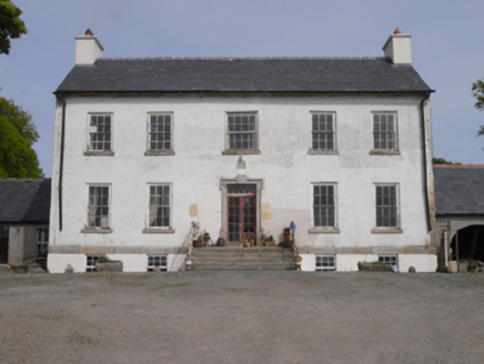 Robinstown HouseFarm house · 1.5 mi
Explorer Tom Robinstown House in Robinstown Great has a name that sounds like a town run by an angry bird colony, but it’s actually…
 Saint Anne's GraveyardGraveyard · 1.6 mi
Explorer Tom In a job interview, Saint Anne's Graveyard would say it’s great under pressure but needs more sunlight and fewer…
 Catholic Church of Saint Anne and Saint JohnChurch/chapel · 1.6 mi
Explorer Tom Catholic Church of Saint Anne and Saint John in Gobbinstown is looking all medieval and mysterious, probably because…
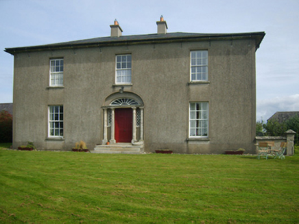 Sweetmount HouseFarm house · 1.8 mi
Explorer Tom Sweetmount House in Rathgaroge is positioned so perfectly to catch every single mountain view that you’d think it was…
 Ogham stone in UnknownOgham stone · 1.8 mi
Explorer Tom Tullycanna's castle site has a plan for retirement involving a lot of napping in the valley. Walter Neville owned it in…
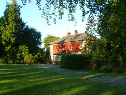 Knockroe HouseFarm house · 1.9 mi
Explorer Tom Knockroe House in Knockroe, County Wexford has a Classically-detailed doorcase that’s mostly hiding behind a later…
 Flat cemetery in BerkeleyFlat cemetery · 1.9 mi
Explorer Tom Flat cemetery in Berkeley is deeply suspicious of the postman, convinced he’s stealing its secrets instead of…
 Fort Garret & Castle (site of)Archaeological place · 1.9 mi
Explorer Tom Fort Garret & Castle hosted a dance in 1601 that went so badly the floor cracked forever. They say the music was so…
 Berkeley ForestWood · 2.3 mi
Explorer Tom Berkeley Forest in Wexford would post a social media update saying it’s having a very 'aesthetic' day, despite the mud…
More archaeology and monuments in County Wexford · All of County Wexford

What do you know about this place?Tap to add a comment or ask a question