What is recorded here
From the Coast Watching Service lookout-post list record EIRE 30
Places near here
Photo credits
- Richard Webb, Geograph · CC BY-SA 2.0
- Maker not stated on source page, www.pinterest.com
- John H Darch, Geograph · Creative Commons Attribution-ShareAlike 2.0
- National Inventory of Architectural Heritage
- Maker not stated on source page, www.dreamstime.com
- Superbass, Wikimedia Commons · CC BY-SA 4.0
- Minseach, Wikimedia Commons · CC BY-SA 4.0
- Mac McCarron, Geograph · CC BY-SA 2.0
- Maker not stated on source page, www.dailymail.co.uk
 Cloghane Signal TowerSignal tower · 149 yd
Explorer Tom Cloghane Signal Tower from 1805 was part of a network to spot French invasions after Bantry failed. Now disused and in…
 Mizen Head BridgeVisitor attraction · 655 yd
Explorer Tom Mizen Head Bridge describes itself to strangers as 'a very important metal thing with great views.' It’s basically a…
 Mizen BridgeFoot bridge · 663 yd
Explorer Tom Mizen Bridge in Cloghane spans a chasm to reach the Signal Station. Built in 1909 with pre-cast concrete elements, it…
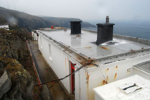 lighthouse keeper's house835 yd
Explorer Tom Lighthouse keeper’s house in Cloghane is still taking the weather’s grudge personally. Built with a fog signal to make…
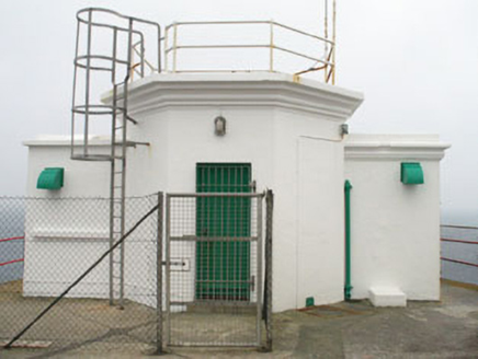 Mizen Head Signal StationSignal tower · 862 yd
Explorer Tom Mizen Head Signal Station in Cloghane is sitting on Ireland's most south-westly point, looking smug about it. It saved…
 Mizen PeakMountain / peak · 864 yd
Explorer Tom Mizen Peak is famous for smugglers who used to hide barrels of wine inside hollowed-out stones. They probably lost most…
 Fairy fort / stone ringfort in Caher (carbery W. (w.d.) By., Kilmore Par.)Fairy fort / stone ringfort · 1.4 mi
Explorer Tom Fairy fort / stone ringfort in Caher By. gave its name to the townland but is now mostly levelled. There were…
 Cross-inscribed stone in DunloughCross-inscribed stone · 1.9 mi
Explorer Tom Cross-inscribed stone in Dunlough has two Maltese crosses that have gone missing like cats from a garden. The rock they…
 Three Castles (in Ruins)Castle, tower house · 2.0 mi
Explorer Tom Three Castles in Dunlough is actually just one main tower with two mural ones, all squeezed into a headland. The stairs…
 Creamery PlatformMemorial · 2.5 mi
Explorer Tom Creamery Platform is posing for its next Instagram post with a single milk churn on top. It separated milk from 1945 to…
 Galley Cove BeachBeach / strand · 3.0 mi
Explorer Tom Galley Cove is a small West Cork beach with a large view. About a mile west of Crookhaven, it gives you sand, sea and a…
 Granny IslandIslet · 3.6 mi
Explorer Tom Granny Island’s favourite song is a lullaby about mud and bad decisions. It sings it loudly at 3 AM for no apparent…
More things to do in County Cork · All of County Cork

What do you know about this place?Tap to add a comment or ask a question