What is recorded here
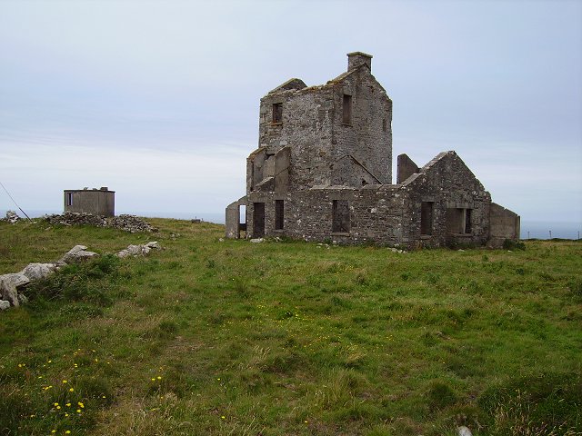
Freestanding two-bay three-stage signal tower, built 1805, now disused. Later three-bay single-storey extension (north-east) and concrete flight of steps (south-east). Pitched roof with rendered chimneystack to north-east gable. Rubble stone walls with remains slate hanging. Square-headed window openings with stone and concrete sills. Square-headed door opening to first floor (south-west) blocked with rubble stone. Later three-bay single-storey extension comprising pitched roof, rubble stone walls, square-headed window openings having concrete sills and lintels with rendered surrounds. Square-headed door opening (south-east) with raised rendered surround and limestone step. Enclosed by rubble stone boundary walls. Single-bay single-storey concrete look-out post, built c. 1940, to south having canted front (south-west) elevation. Comprising flat roof, concrete walls and square-headed openings.
One of a network of signal towers built around the south, east and west coasts in the early nineteenth century to ensure a quick response to attempted invasion, following a failed effort by a French fleet to land at Bantry in 1796. Though now in ruins, this example is typical of the square-plan and first floor entrance style of these signal towers. The World War II look-out post provides an interesting contrast, with very different form and materials providing similar defensive and communication functions.
From the Buildings of Ireland (National Inventory of Architectural Heritage) record 20915202
This does not grant access. Most recorded buildings are privately owned; view them only from public ground unless the owner allows entry.
Places near here
Photo credits
- John H Darch, Geograph · Creative Commons Attribution-ShareAlike 2.0
- National Inventory of Architectural Heritage
- Ent-ente, Wikimedia Commons · CC BY-SA 3.0
- Richard Webb, Geograph · CC BY-SA 2.0
- Superbass, Wikimedia Commons · CC BY-SA 4.0
- Minseach, Wikimedia Commons · CC BY-SA 4.0
- Mac McCarron, Geograph · CC BY-SA 2.0
- Richard Webb, Wikimedia Commons · CC BY-SA 2.0
Field boundary in Cloghane (carbery W. (w.d.) By.)Field boundary · 319 ydFastnet Lighthouse Centenary Stone-CourseMemorial · 412 ydPromontory fortPromontory fort, coastal · 460 yd Mizen BridgeFoot bridge · 526 ydlighthouse keeper's house707 ydMizen Head Signal StationSignal tower · 738 ydMizen HeadHeadland · 757 ydMizen PeakMountain / peak · 996 ydThree Castles (in Ruins)Castle, tower house · 2.1 miCreamery PlatformMemorial · 2.6 miGalley Cove BeachBeach / strand · 3.0 miKnocknamaddreeMountain / peak · 4.8 mi
 Mizen BridgeFoot bridge · 526 yd
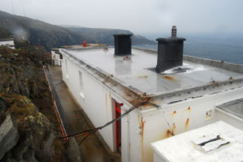 lighthouse keeper's house707 yd
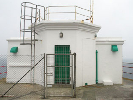 Mizen Head Signal StationSignal tower · 738 yd
 Mizen HeadHeadland · 757 yd
 Mizen PeakMountain / peak · 996 yd
 Three Castles (in Ruins)Castle, tower house · 2.1 mi
 Creamery PlatformMemorial · 2.6 mi
 Galley Cove BeachBeach / strand · 3.0 mi
 KnocknamaddreeMountain / peak · 4.8 mi
More historic places in County Cork · All of County Cork
What do you know about this place?