
What is recorded here
From the National Monuments Service (Archaeological Survey of Ireland) record WM006-081
Places near here
Photo credits
- Maker not stated on source page, visionsofthepastblog.com
- National Inventory of Architectural Heritage
- Maker not stated on source page, www.dreamstime.com
- Maker not stated on source page, commons.wikimedia.org
- Stephan van Helden, Wikimedia Commons · CC BY-SA 4.0
- Maker not stated on source page, en.wikipedia.org
- Miguel Angel Masegosa Martínez, Wikimedia Commons · CC BY 2.0
- Maker not stated on source page, letsgowiththechildren.co.uk
 Site of CastleCastle, unclassified · 76 yd
Explorer Tom Site of Castle in Ballycorkey bragged about surviving a storm that probably just moved into the next town over. The…
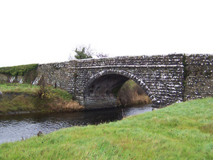 Ballycorkey BridgeBridge · 187 yd
Explorer Tom Ballycorkey Bridge in Rathclittagh is a robust mid-nineteenth-century road bridge dated 1857, built by the Board of…
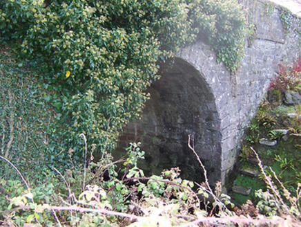 Ardglass BridgeBridge · 1.0 mi
Explorer Tom Ardglass Bridge in Corry is a mid-nineteenth-century beauty that looks like it skipped the heavy rustication trend…
 Mapped graveyardGraveyard · 1.1 mi
Explorer Tom Mapped graveyard in County Westmeath makes a really spooky creaking sound at night that is definitely just the wind…
 CastleCastle, motte and bailey · 1.2 mi
Explorer Tom Joanstown Motte and Bailey would post a selfie from the riverbank with the caption 'Wet but worth it.' It is…
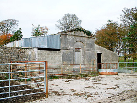 Baronstown HouseOfficially recorded historic building · 1.5 mi
Explorer Tom Baronstown House is actually just a gate lodge pretending to be the star of the show while the real mansion hides in…
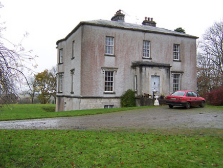 Crumlin HouseCountry house · 1.5 mi
Explorer Tom Crumlin House ended up in the wrong place because it couldn’t decide if it was 1795 or 1838. That elegant bow on the…
 Horse-chestnut1.6 mi
Explorer Tom Horse-chestnut in County Westmeath would bring a bag of conkers and a very strong opinion on what constitutes a good…
 Bridget's WellSpring · 1.6 mi
Explorer Tom Bridget's Well had a fox take full charge last Tuesday and he’s still running the show with absolute authority. He…
 Sweet Chestnut1.7 mi
Explorer Tom Sweet Chestnut in County Westmeath has been locked in a bitter feud with the village over who left a half-eaten…
 Flat cemetery in EmperFlat cemetery · 2.3 mi
Explorer Tom Flat cemetery in Emper, County Westmeath is where a poet once fell into a ditch and wrote an epic about it before…
 Fairy fort / earthen ringfort in EmperFairy fort / earthen ringfort · 2.5 mi
Explorer Tom Fairy fort / earthen ringfort in Emper brags about surviving a storm that flattened every other hill in the area. It…
More archaeology and monuments in County Westmeath · All of County Westmeath

What do you know about this place?Tap to add a comment or ask a question