What is recorded here
From the National Monuments Service (Archaeological Survey of Ireland) record ME017-031005
Places near here
Photo credits
- Maker not stated on source page, www.pinterest.com
- Maker not stated on source page, au.pinterest.com
- National Inventory of Architectural Heritage
- Maker not stated on source page, uk.pinterest.com
- Maker not stated on source page, historichotelsofeurope.com
- Maker not stated on source page, commons.wikimedia.org
- Maker not stated on source page, www.tripadvisor.com.ph
- HoganStand / Wolfe Tones match report; photographer not named, hoganstand.com
- Jean-Pol GRANDMONT, Wikimedia Commons · CC BY 3.0
- Kmcnamee, Wikimedia Commons · CC BY-SA 4.0
 Church (in Ruins)Church · 15 yd
Explorer Tom Church in Tailtin would introduce itself as 'the one that got burnt down by a guy named Dermot in 1170' and then shrug…
 Cross-inscribed stone in TailtinCross-inscribed stone · 19 yd
Explorer Tom Cross-inscribed stone in Tailtin is a damaged headstone trying to hold itself together with a cross that looks like it…
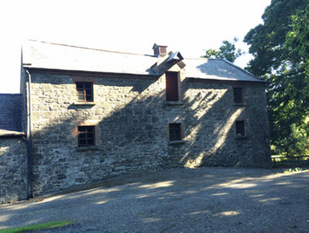 Martry MillMill (water) · 782 yd
Explorer Tom Martry Mill bragged about surviving a storm that supposedly flattened half of County Meath, though I suspect it just…
 Fairy fort / earthen ringfort in Tankardstown (navan Lower By.)Fairy fort / earthen ringfort · 1136 yd
Explorer Tom Fairy fort / earthen ringfort in Tankardstown would handle a nosey neighbour by pretending to be a very boring hill…
 Stone sculpture (present location) in Diméin Bhaile GhibStone sculpture (present location) · 1591 yd
Explorer Tom Stone sculpture in Diméin Bhaile Ghib ended up here from Randalstown Castle after a very awkward move. It’s got a sash…
 Memorial stone (present location) in Diméin Bhaile GhibMemorial stone (present location) · 1592 yd
Explorer Tom Memorial stone in Diméin Bhaile Ghib has a crest with stars and waves that looks like someone spilled glitter on the…
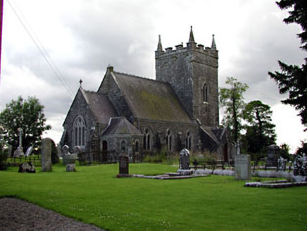 Saint Patrick's Church (Donaghpatrick)Church/chapel · 1598 yd
Explorer Tom Saint Patrick's Church (Donaghpatrick) was designed by a mother-in-law who liked her windows with stained glass and her…
 St. Patricks churchChurch · 1602 yd
Explorer Tom St. Patricks church sits on a bluff where the rabbits probably hold council meetings. They think the view is for them…
 presbytery/parochial/curate's house1644 yd
Explorer Tom Presbytery in Donaghpatrick would describe itself as 'colourful and slightly chaotic' when talking to a stranger. It…
 Gibbstown, Wolfe TonesGAA ground · 1.1 mi
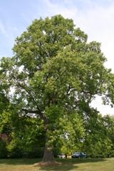 Tuliptree1.3 mi
Explorer Tom Tuliptree in County Meath made a New Year's resolution to stop looking so fancy. It failed spectacularly, of course…
 Kilmainham GAA pitchGAA ground · 2.0 mi
More archaeology and monuments in County Meath · All of County Meath

What do you know about this place?Tap to add a comment or ask a question