What is recorded here
Situated in the valley of a small SE-NW stream, with a SSE-NNW section of the stream forming the E edge, and c. 700m from where the stream joins the NE-SW River Bann. This is the site of an early monastery and the Romanesque parish church of Clone (WX015-023001-) within a D-shaped graveyard (WX015-0230002-). During…
Read the whole record
Situated in the valley of a small SE-NW stream, with a SSE-NNW section of the stream forming the E edge, and c. 700m from where the stream joins the NE-SW River Bann. This is the site of an early monastery and the Romanesque parish church of Clone (WX015-023001-) within a D-shaped graveyard (WX015-0230002-). During the summer of 2018 a drone-mounted camera operated by Dinny Kinsella enabled Barry Lacey to identify part of the ecclesiastical enclosure (ext. diam. c. 180m NW-SE; int. diam. c. 140m NW-SE) of the original monastery as the cropmark of two parallel fosse features placed close together extending W from the stream, curving S of the graveyard and joining the curve of the road SW of the graveyard. The road and a curving field boundary further N complete three quarters of a circle backing onto the stream. Following on from this, a fluxgate gradiometer survey (19R0274) determined that there is an inner D-shaped enclosure (int. dims c. 140m N-S; c. 110m E-W) defined again partially by two fosses placed close to each other and c. 20m inside the outer enclosure, and a third innermost enclosure (dims c. 100m E-W; c. 90m N-S) extending in a tangential fashion from the W side of the graveyard, N and E to the stream. Many of the enclosing features can be seen on Google Earth (14/07/2018). The middle enclosure has two straight NNW-SSE fosses c. 15m and c. 30m E of the graveyard forming the straight E side. Archaeological testing (19E0766) across the inner fosse of the outer enclosure SW of the graveyard proves it to be a flat bottomed ditch (Wth of top 3.04m; Wth of base c. 0.8m; D 1.2m) with five fills which may have eroded from banks inside and outside the ditch. A sample of charcoal from this ditch provides the surprising C14 result of 3716-3954 cal. BC, placing it very early in the Neolithic. A test trench across the fosses of what is thought to be the middle enclosure SW of the graveyard revealed a wide ditch (Wth of top 3.25m; D 1.5m) that has five fills, with a smaller ditch (Wth of top 1.1m; D 0.9m) 1.3m inside it with similar fills, and another ditch (Wth of top 2.2m; D 0.8m) immediately outside the wide ditch. No artefacts were recovered and the upper levels in both trenches were cut by furrows, but a charcoal sample from the upper levels of the large ditch produced a radiocarbon date of cal. AD 66-821 (Shine et al. 2020). (Shine and Lacey 2020)
See the attached aerial views courtesy of Dinny Kinsella and Barry Lacey: _1 from N; _2 from S
Compiled by: Michael Moore
Date of upload; 15 August, 2018
Amended: 19 November 2020; 7 December 2020
From the National Monuments Service (Archaeological Survey of Ireland) record WX015-023013
Places near here
Photo credits
- National Inventory of Architectural Heritage
- liam murphy, Wikimedia Commons · CC BY-SA 2.0
- 瑞丽江的河水, Wikimedia Commons · CC BY-SA 4.0
- Sciadopitys from UK, Wikimedia Commons · CC BY-SA 2.0
- Sitomon, Wikimedia Commons · CC BY-SA 2.0
- Darrin Antrobus, Wikimedia Commons · CC BY-SA 2.0
- MikeWest Wexford, Wikimedia Commons · CC BY-SA 4.0
- Colin Park, Geograph · CC BY-SA 2.0
Burnt spread in CloneBurnt spread · 127 ydEmbanked enclosureFairy fort / ringfort · 346 yd Doran's BridgeBridge · 1489 ydTomsallagh HouseFarm house · 1681 ydFerns CastleVisitor attraction · 1.6 miFerns Castle (in ruins)Castle, Anglo-Norman masonry castle · 1.6 miEuropean Larch5.2 miEuropean Yew5.2 miBattle of EnniscorthyBattle · 5.3 miEnniscorthy CastleMuseum · 5.3 miIndicatedCastle, tower house · 5.3 miBattlefield in EnniscorthyBattlefield · 5.3 mi
 Doran's BridgeBridge · 1489 yd
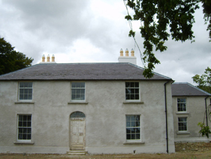 Tomsallagh HouseFarm house · 1681 yd
 Ferns CastleVisitor attraction · 1.6 mi
 Ferns Castle (in ruins)Castle, Anglo-Norman masonry castle · 1.6 mi
 European Larch5.2 mi
 European Yew5.2 mi
 Battle of EnniscorthyBattle · 5.3 mi
 Enniscorthy CastleMuseum · 5.3 mi
 IndicatedCastle, tower house · 5.3 miBattlefield in EnniscorthyBattlefield · 5.3 mi
More archaeology and monuments in County Wexford · All of County Wexford

What do you know about this place?Tap to add a comment or ask a question