
What is recorded here
From the National Monuments Service (Archaeological Survey of Ireland) record LI057-022
Places near here
Photo credits
- Maker not stated on source page, www.dreamstime.com
- Colin Park, Geograph · Creative Commons Attribution-ShareAlike 2.0
- Maker not stated on source page, www.wikidata.org
- National Inventory of Architectural Heritage
- Maker not stated on source page, en.wikipedia.org
- Glenroe Hurling Club official website; individual aerial photographer not named, glenroegaa.com
- john salter, Geograph · CC BY-SA 2.0
 Church in KilgarriffChurch · 1.0 mi
Explorer Tom Church in Kilgarriff got completely lost on the map because the cartographer was having a bad day and a worse cup of…
 Ballintober BridgeBridge · 1.1 mi
Explorer Tom Ballintober Bridge is stuck in a fairy dispute over who gets to park their magic carriage there first. The arches are…
 Fairy fort / earthen ringfort in BallyfeerodeFairy fort / earthen ringfort · 1.4 mi
Explorer Tom Fairy fort / earthen ringfort in Ballyfeerode is arguing with the river over parking rights. It’s got a diamond-shaped…
 presbytery/parochial/curate's house1.4 mi
Explorer Tom Ballyshane’s presbytery inspired a bad poem about its porch that rhymed 'limestone' with 'gloaming'. The pediment is…
 Stone Grave called Druids BedStanding stone · 1.5 mi
Explorer Tom Stone Grave called Druids Bed in Ballynacourty is there because the map makers got completely confused by the name. It…
 Glenroe GAA pitchGAA ground · 1.5 mi
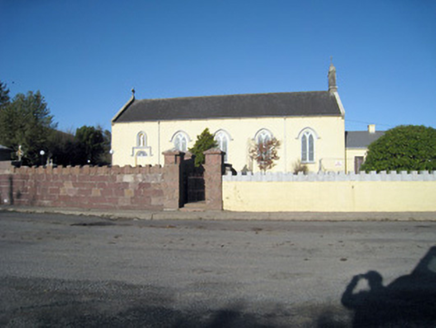 Catholic Church of Our Lady of RansomChurch/chapel · 1.6 mi
Explorer Tom Our Lady of Ransom church in Ballyshane started from a bet two lads made in the pub. The limestone carvings are holding…
 Barrabunocka BridgeBridge · 1.8 mi
Explorer Tom Barrabunocka Bridge nearly got famous when a goat tried to cross it and got stuck halfway, blocking traffic for an…
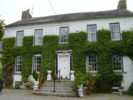 Spring LodgeCountry house · 2.7 mi
Explorer Tom Spring Lodge in Kilfinnane is planning retirement by turning into a very fancy garden shed for the local cats. It has…
 Bosnetstown VillaHouse · 3.2 mi
Explorer Tom Bosnetstown Villa is being claimed by a local who says he invented symmetry himself. He swears the chimneys were his…
 monument3.4 mi
Explorer Tom The Monument in Knockanevin is a high cross that’s been standing since 1945, honoring local heroes. It’s surrounded by…
 Saint Molaga's ChurchChurch/chapel · 3.5 mi
Explorer Tom Saint Molaga's Church in Knockanevin is all Gothic Revival from the 1820s. It has a bellcote that looks like it’s…
More archaeology and monuments in County Limerick · All of County Limerick

What do you know about this place?Tap to add a comment or ask a question