
Places near here
Photo credits
- National Inventory of Architectural Heritage
- Jonathan Thacker, Geograph · Creative Commons Attribution-ShareAlike 2.0
- Jonathan Thacker, Geograph · CC BY-SA 2.0
- dougf, Geograph · CC BY-SA 2.0
- Willow, Wikimedia Commons · CC BY 2.5
- Maker named on the Wikimedia Commons picture page · Public domain
- Derek Ryan Bawn, Wikimedia Commons · CC BY-SA 4.0
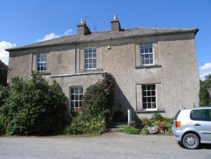 The Old RectoryRectory/glebe/vicarage/curate's house · 595 yd
Explorer Tom The Old Rectory in Lorrha refuses to fall down because it’s too proud of its crown glass windows. It’s a Board of First Fruits classic, still standing strong as a family home. Look at the masonry and nod.
IndicatedEcclesiastical enclosure · 724 ydExplorer Tom Ecclesiastical enclosure in Lorrha has been hiding a massive scandal about a monk who married a goat for centuries without anyone checking the paperwork. It’s just sitting there looking innocent while the secret festers underneath the holy well and high crosses. Pop by and tell it it's looking well.
 Saint Ruadhan's Church (Lorrha)Church/chapel · 787 yd
Explorer Tom Saint Ruadhan's Church in Lorrha has a curse that only hits people who forget to wave at the medieval ruin behind it. The bell hangs in the old gable like it’s keeping time for a very slow dance. Keep your eyes on the leaded glass while you admire the setup.
 Lackeen Castle (in Ruins)Bawn · 1.5 mi
Explorer Tom Lackeen Castle in Abbeville is hugging its rock outcrop like a grumpy grandpa refusing to leave his armchair. The bawn is basically a giant stone pen that lost all its sheep but kept the attitude. Pat it from afar; it’s had a long, quiet life.
 Ballyquirke castle (in ruins)Castle, tower house · 1.8 mi
Explorer Tom Ballyquirke Castle is proud of one thing: it managed to disappear completely before anyone could take a proper photo. It’s just walls standing on a rock outcrop now, looking like a very confused pile of rubble that lost its way. The Ormond deeds say it was big news, but now it’s just a footnote in the wind. Toast it with a cup of tea and move on to the next.
Sallow IslandIsland · 2.9 miExplorer Tom Sallow Island is secretly proud of a single potato it grew last summer which it treats like a royal heirloom passed down through generations of dirt. It polishes this spud with a rag and shows it off to anyone who will look at it for even a second. Ideal for a moody photo you'll pretend wasn't posed.
Portland IslandIsland · 3.0 miExplorer Tom Portland Island has a bird that refuses to leave despite offers of relocation to warmer climates, claiming it has roots here even though birds technically don’t have any at all. It’s very stubborn and squawks at anyone who suggests it could live somewhere with better weather or fewer tourists around. Wave at the cows, they're the real locals anyway.
Slevoir BayBay · 3.2 miExplorer Tom Slevoir Bay is having a massive dramatic standoff with the nearest tree, which keeps leaning in too close for comfort. The bay is furious about this and keeps throwing waves at it like little angry fists. It’s a lovely place to watch nature pretend everything is fine while chaos brews. Count the crows, then count again.
 European ash4.0 mi
Explorer Tom European ash wants its tombstone to say 'He was tall, he was cool, and he never once dropped a leaf on your head.' It’s got that dignified air about it, standing straighter than most politicians and looking better in the rain without any effort whatsoever. Pack a picnic and an excuse.
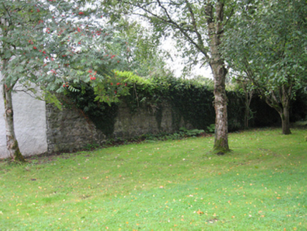 Portumna CastleWalled garden · 4.4 mi
Explorer Tom This walled garden refuses to fall down because it’s too stubborn to admit it’s useless. The bricks are holding on for dear life, mostly out of sheer spite. Pop by and tell it it's looking absolutely magnificent today.
 Black mulberry4.6 mi
Explorer Tom Black mulberry in County Galway once caught a poet’s eye and his boot in a ditch nearby. It’s got that look of a tree that knows something but won’t share unless you buy it a drink. Take a mate and argue about what it was for.
 BarrowBarrow, mound barrow · 5.1 mi
Explorer Tom Barrow in Lismacrory is basically a giant stone ear, but locals claim it’s actually a listening post for aliens who just wanted a quiet spot. The name? Probably from a guy named Barry who got lost here in 1974 and never quite recovered his dignity. Whisper a secret at it, it's kept worse.
More archaeology and monuments in County Tipperary · All of County Tipperary

What do you know about this place?Tap to add a comment or ask a question