
What is recorded here
From the National Monuments Service (Archaeological Survey of Ireland) record CW024-058
Places near here
Photo credits
- Maker not stated on source page, www.theirishplace.com
- kevin higgins, Wikimedia Commons · CC BY-SA 2.0
- kevin higgins, Geograph · Creative Commons Attribution-ShareAlike 2.0
- Maker not stated on source page, commons.wikimedia.org
- Maker not stated on source page, www.pinterest.com
- Maker not stated on source page, www.youtube.com
- A.-K. D., Wikimedia Commons · CC BY-SA 4.0
- National Inventory of Architectural Heritage
- kevin higgins, Wikimedia Commons
- kevin higgins, Geograph · CC BY-SA 2.0
- Sarah777, Wikimedia Commons · Public domain
 Stone row in CoolyhuneStone row · 963 yd
Explorer Tom Stone row in Coolyhune was supposedly white quartz boulders, but nobody found them in 1987. They probably packed up and…
 Carriglead LockLock · 981 yd
Explorer Tom Carriglead Lock is a water lift that's seen more boats than your local pub has seen tourists. The keeper's house is…
 Lower Tinnahinch LockLock · 1168 yd
Explorer Tom Lower Tinnahinch Lock has a lock-keeper’s house with external steps, proving you should never trust indoor plumbing.…
 Galmoy Castle (in ruins)House, 17th century · 1507 yd
Explorer Tom Galmoy Castle in Ballyogan is hiding better than I do before a dentist. A 17th-century house that nobody can find? It’s…
 Holy well in TinnahinchHoly well · 1736 yd
Explorer Tom Holy well in Tinnahinch is actually known as St. Vincent's Well, but nobody seems to remember the details anymore. The…
 Saint Michael's CemeteryCemetery · 1.2 mi
Explorer Tom Saint Michael's Cemetery in County Carlow thinks it’s a five-star hotel where nobody checks out. It’d tell a stranger…
 St. Michaels Church (in Ruins), GraveyardChurch · 1.2 mi
Explorer Tom St. Michaels Church, Graveyard in Tinnahinch has wall foundations and a west gable made of split stone, which is…
 Earthwork in HarristownEarthwork · 1.2 mi
Explorer Tom Earthwork in Harristown is an oval enclosure that bragged about surviving a massive storm but now has no visible…
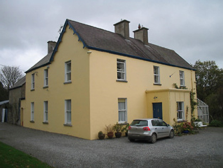 Bellevue HouseHouse · 1.2 mi
Explorer Tom Bellevue House in Graiguenamanagh, County Kilkenny is gazing at the River Barrow with dramatic flair. It thinks it’s…
 Cushendale Woollen MillsHeritage attraction · 1.5 mi
Explorer Tom Cushendale Woollen Mills in Graiguenamanagh is the sort of place where a bundle of fleece can walk in looking like a…
 Freney's WellSpring · 2.1 mi
Explorer Tom Freney's Well is secretly proud of the potato it grew last year because it was so big it had to be carried on two men’s…
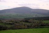 Brandon HillMountain / peak · 2.4 mi
Explorer Tom Brandon Hill gives Kilkenny a proper high point, beyond the county's castles and shops. From Graiguenamanagh the walk…
More archaeology and monuments in County Carlow · All of County Carlow

What do you know about this place?Tap to add a comment or ask a question