
What is recorded here
From the National Monuments Service (Archaeological Survey of Ireland) record TN036-005
Places near here
Photo credits
- Mike Searle, Geograph · CC BY-SA 2.0
- National Inventory of Architectural Heritage
- Moyne-Templetuohy GAA / Tipperary GAA club profile; individual photographer not named, tipperary.gaa.ie
- Maker not stated on source page, hu.pinterest.com
- Maker not stated on source page, www.pinterest.com
- Maker not stated on source page, www.dreamstime.com
- Maker not stated on source page, en.wikipedia.org
 Killoran HouseCountry house · 1.4 mi
Explorer Tom Killoran House reviews its own visitors by rating their hats out of ten based on how well they match the elaborate…
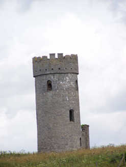 Killoran TowerFolly · 1.5 mi
Explorer Tom Killoran Tower is a folly, which means it’s basically a fancy garden gnome for people who can’t afford castles. It’s…
 Templetuohy GAA Pitch, Moyne-TempletuohyGAA ground · 1.6 mi
 Flat cemetery in Killoran (moyne Par.)Flat cemetery · 1.7 mi
Explorer Tom Flat cemetery in Killoran would teach history by making you dig holes for an hour and then telling you they were just…
 Templetuohy CemeteryCemetery · 1.8 mi
Explorer Tom Templetuohy Cemetery holds a long grudge against the weather because it keeps ruining its hair. The clouds seem to know…
 Catholic Church of the Sacred HeartChurch/chapel · 1.8 mi
Explorer Tom Catholic Church of the Sacred Heart in Longorchard is all flash with its rock-faced limestone and smooth ashlar…
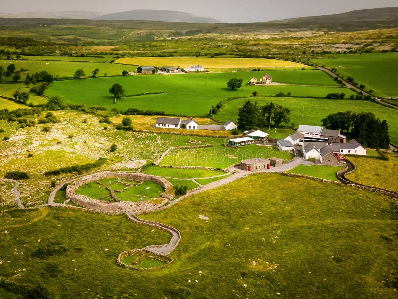 Fairy fort / earthen ringfort in LisdonowleyFairy fort / earthen ringfort · 2.3 mi
Explorer Tom Fairy fort / earthen ringfort in Lisdonowley is playing hard to get in Tipperary. The bank is barely half a metre high…
 Church (in Ruins)Graveyard · 2.3 mi
Explorer Tom Church in Baunaghra is gone, leaving only a ghost too lazy to haunt the corn crops now. The graveyard was demolished in…
 Moyne Church (in Ruins)Graveyard · 2.7 mi
Explorer Tom Moyne Church in Moynetemple is playing hard to get, sitting on a low rise with a graveyard that looks like it’s been…
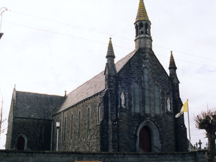 Saint Mary's Catholic ChurchChurch/chapel · 2.7 mi
Explorer Tom Saint Mary's in Moynetemple is playing dress-up with Gothic spikes next to an actual medieval ruin! The ashlar…
 Castle (in ruins)House, fortified house · 3.2 mi
Explorer Tom Castle in Castletown is having a massive family feud over who actually owns the view of the Black River. The walls are…
 Castletown Castle (ruins)Archaeological place · 3.2 mi
Explorer Tom Castletown Castle had a brief fling with a famous rock star in the seventies who got lost on his way to a gig and…
More archaeology and monuments in County Tipperary · All of County Tipperary

What do you know about this place?Tap to add a comment or ask a question