
What is recorded here
From the National Monuments Service (Archaeological Survey of Ireland) record CO097-062
Places near here
Photo credits
- National Inventory of Architectural Heritage
- Maker not stated on source page, www.dreamstime.com
- Maker not stated on source page, commons.wikimedia.org
- Maker not stated on source page, www.castlepedia.org
- Maker not stated on source page, www.pinterest.com
- Golfing in Ireland; photographer not stated, Source publisher
- Kmcnamee, Wikimedia Commons · CC BY-SA 4.0
- Picture: Discover Ireland
- Christopher Michel, Wikimedia Commons
- Picture: The Boathouse Gallery
- Maker not stated on source page, www.flickr.com
 Farlistown HouseHouse · 1647 yd
Explorer Tom Farlistown House in County Cork claims a fake royal visit happened in 1892, but nobody can disprove it because everyone…
 Fairy fort / earthen ringfort in LissheedaFairy fort / earthen ringfort · 1.2 mi
Explorer Tom Fairy fort in Lissheeda is having a serious drama with the nearest tree because the tree’s roots are getting too close…
 Church in ClogheenduaneChurch · 1.4 mi
Explorer Tom Church in Clogheenduane has an imaginary twin across the sea that probably looks exactly like it but with better PR and…
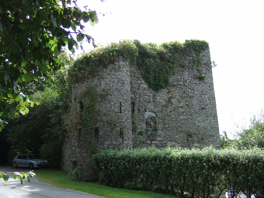 Poulnalong Castle (in Ruins)Castle, tower house · 1.6 mi
Explorer Tom Poulnalong Castle in Ship-Pool is perched on a steep bank above the Bandon River. It has a circular turret at the…
 Leighmoney CastleArchaeological place · 2.0 mi
Explorer Tom Leighmoney Castle would want 'Here lies a rock that thought it was a castle' carved onto its tombstone. It has been an…
 Mapped cemeteryCemetery · 2.5 mi
Explorer Tom Mapped cemetery in County Cork was designed by a mother-in-law who couldn’t stand the neighbors, so she made sure every…
 Kinsale Golf ClubGolf course · 3.1 mi
 Pitch 2, BallinhassigGAA ground · 4.2 mi
 Blacks Brewery & DistilleryHeritage attraction · 4.9 mi
Explorer Tom At Cappagh near Kinsale, Blacks has put a brewery and distillery under one roof, apparently because making just one…
 KinsaleHistoric town · 5.0 mi
Explorer Tom You might call Kinsale picturesque. The harbour once called it strategic. Kinsale is a town built around a harbour that…
 The Boathouse GalleryGallery · 5.0 mi
Explorer Tom At 68 Main Street in Kinsale, the Boathouse Gallery has pulled off a tidy trick: a building erected as a steam bakery…
 Knoppoge WoodWood · 5.9 mi
Explorer Tom Knoppoge Wood in County Cork would absolutely flake out on a reality show because it thinks its own name is too fancy…
More archaeology and monuments in County Cork · All of County Cork

What do you know about this place?Tap to add a comment or ask a question