
What is recorded here
Located on a low ridge running N-S at the base of a hill overlooking a tributary of the Brosna river. Moatquarter motte (TN016-003----) in Co. Tipperary 185m to NE with medieval church ruins (OF047-009----) 140m to SE. Hachured as a rectangular platform on all editions of the OS 6-inch maps. A rectangular platform…
Read the whole record
From the National Monuments Service (Archaeological Survey of Ireland) record OF047-008
Places near here
Photo credits
- Maker not stated on source page, en.wikipedia.org
- National Inventory of Architectural Heritage
- Maker not stated on source page, www.geograph.ie
- Maker not stated on source page, www.flickr.com
- AEJones, Wikimedia Commons · CC BY-SA 4.0
- Maker not stated on source page, www.pinterest.com
- Maker not stated on source page, www.tripadvisor.com
- Maker not stated on source page, archaeology.co.uk
- Maker not stated on source page, www.tripadvisor.com.au
- Maker not stated on source page, ch.pinterest.com
 Graveyard in DrumroeGraveyard · 227 yd
Explorer Tom Drumroe’s graveyard sits on high ground with a church that has a wobbly north wall. It would describe itself to a…
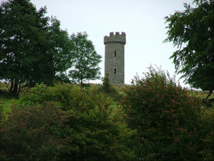 Busherstown TowerFolly · 679 yd
Explorer Tom Busherstown Tower is basically a fancy hat for a hill that nobody actually lives in anymore. A fox took charge of the…
 Fairy fort / earthen ringfort in DrumroeFairy fort / earthen ringfort · 1061 yd
Explorer Tom Fairy fort / earthen ringfort in Drumroe is perched on a slope like it’s judging your outfit. A bishop refused to visit…
 Bullaun stone in LoughanBullaun stone · 1189 yd
Explorer Tom Bullaun stone in Loughan inspired someone to write a bad poem about its shallow depressions, and it’s still not over…
 Busherstown HouseCountry house · 1288 yd
Explorer Tom Busherstown House in County Offaly is wearing a medieval costume over a modern body, which is a bit like wearing a top…
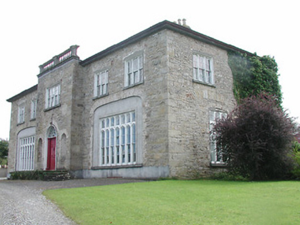 Lisduff HouseCountry house · 1512 yd
Explorer Tom Lisduff House in Rathnaveoge is that person at the wedding who stands slightly apart but still demands everyone’s…
 Lawn WoodForest · 1519 yd
Explorer Tom Lawn Wood in County Tipperary had a prophecy that it would turn into gold, but then someone invented the internet and…
 CastleCastle, unclassified · 1.0 mi
Explorer Tom Castle in Castleroan would write on its dating profile 'looking for someone who doesn’t mind being invisible', and…
 The RectoryRectory/glebe/vicarage/curate's house · 1.0 mi
Explorer Tom The Rectory in Franckfort is dressed up for a party that ended decades ago, with all those curvilinear gables wiggling…
 Fairy fort / earthen ringfort in HoneymountFairy fort / earthen ringfort · 1.1 mi
Explorer Tom Fairy fort / earthen ringfort in Honeymount wants its tombstone to read: 'He only had one good side, but he made the…
 Dunkerrin New CemeteryGraveyard · 1.7 mi
Explorer Tom Dunkerrin New Cemetery was supposed to be hit by lightning every full moon according to an old prophecy. The sky stayed…
 Franckfort CastleCastle, unclassified · 1.9 mi
Explorer Tom Franckfort Castle in Franckfort has a dog that’s definitely in charge, even if you can’t see it. The datestone says…
More archaeology and monuments in County Offaly · All of County Offaly

What do you know about this place?Tap to add a comment or ask a question