
What is recorded here
From the National Monuments Service (Archaeological Survey of Ireland) record LI045-109
Places near here
Photo credits
- Maker not stated on source page, en.wikipedia.org
- Maker not stated on source page, commons.wikimedia.org
- Maker not stated on source page, tr.pinterest.com
- Maker not stated on source page, www.gettyimages.com
- National Inventory of Architectural Heritage
- Kmcnamee, Wikimedia Commons · CC BY-SA 4.0
- Maker not stated on source page, www.geograph.ie
- Feohanagh Castlemahon GAA Club official website; drone photographer not stated, feohanaghcastlemahongaa.ie
- Maker not stated on source page, uk.pinterest.com
- Mike Searle, Geograph · CC BY-SA 2.0
 Church in Kilcolman (connello Upper By.)Church · 542 yd
Explorer Tom Church in Kilcolman has one very specific visitor it absolutely refuses to acknowledge, probably because they kept…
 Fairy fort / earthen ringfort in AhaveheenFairy fort / earthen ringfort · 1179 yd
Explorer Tom Fairy fort / earthen ringfort in Ahaveheen is bisected by a drain and covered in bushes, looking thoroughly…
 Fairy fort / earthen ringfort in MundellihyFairy fort / earthen ringfort · 1440 yd
Explorer Tom Fairy fort / earthen ringfort in Mundellihy refuses to fall down because it’s being stubborn about the view of the…
 Mapped cemeteryCemetery · 1456 yd
Explorer Tom Mapped cemetery in County Limerick has a family tree that is ninety percent invented by people who were drunk or bored…
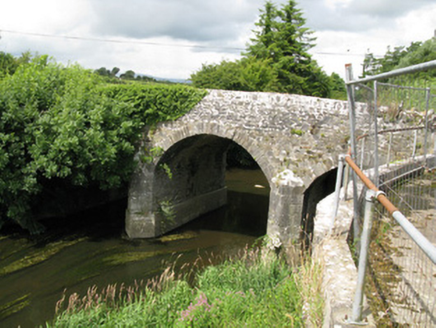 Broken BridgeBridge · 1644 yd
Explorer Tom Broken Bridge in Cloonpasteen has a superstition that if you cross it at midnight, you’ll find your lost keys somewhere…
 Feenagh/Kilmeedy GAA pitchGAA ground · 1653 yd
 Fairy fort / earthen ringfort in DrominacreenFairy fort / earthen ringfort · 1.2 mi
Explorer Tom Fairy fort / earthen ringfort in Drominacreen would tell its younger self to stop being so fancy. It’s just a bank now…
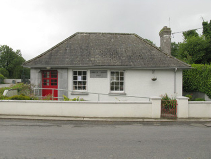 Feenagh Carnegie LibraryLibrary/archive · 1.6 mi
Explorer Tom Feenagh Carnegie Library is holding a fake world record for 'Most Dignified Silence' because it’s too proud to talk…
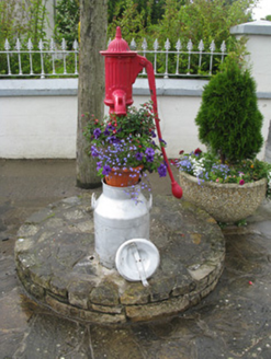 water pump1.7 mi
Explorer Tom Water pump in Gortmore is haunted by a ghost who is too lazy to even scare you properly. It used to be the village’s…
 Quaid Park, Feohanagh/CastlemahonGAA ground · 2.7 mi
 Castle (in Ruins)Castle, tower house · 4.8 mi
Explorer Tom Castle in Castlelishen, County Cork is hiding in a farmyard with a wide round-arched door that definitely wasn’t…
 Glenduff CastleCastle, tower house · 5.4 mi
Explorer Tom Glenduff Castle would post a selfie of its replica tower and caption it 'vintage vibes'. It burnt in 1922 but still…
More archaeology and monuments in County Limerick · All of County Limerick

What do you know about this place?Tap to add a comment or ask a question