
What is recorded here
In pasture on a slight N-facing slope, with good views in all directions. The earthworks and property plots are located within the historic medieval town of Adare (LI021-032001-). They are to the W, SW and S of the Augustinian Abbey (LI021-032006-) and extend from the banks of the River Maigue in the N, to the High…
Read the whole record
From the National Monuments Service (Archaeological Survey of Ireland) record LI021-032020
Places near here
Photo credits
- National Inventory of Architectural Heritage
- Adareman, Wikimedia Commons · CC BY-SA 4.0
- Peter Craine, Wikimedia Commons · CC BY-SA 2.0
- John Baker, Geograph · CC BY-SA 2.0
- Sitomon, Wikimedia Commons · CC BY-SA 2.0
- Malene Thyssen, Wikimedia Commons · CC BY-SA 3.0
- Golfing in Ireland; photographer not stated, Source publisher
- Callanmurphy, Wikimedia Commons · CC BY-SA 4.0
- Maker not stated on source page, uk.pinterest.com
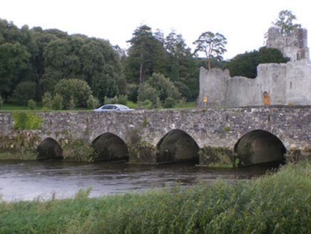 Adare BridgeBridge · 293 yd
Explorer Tom Adare Bridge in Adare holds a fake world record for the most arches used to cross a single river without getting bored.…
 The RectoryRectory/glebe/vicarage/curate's house · 352 yd
Explorer Tom The Rectory in Blackabbey survived a storm that allegedly ate a goat. It just stood there with its box windows looking…
 Adare CourthouseCourt house · 449 yd
Explorer Tom Adare Courthouse looks like two houses having an affair, but it’s actually just very confused about its identity. An…
 Desmond CastleHeritage attraction · 451 yd
Explorer Tom Desmond Castle in County Limerick had its first owner planning an escape route that probably led straight into the…
 Adare Desmond CastleMedieval castle · 453 yd
Explorer Tom Adare Desmond Castle was built in the twelfth century but got dismantled in 1657, which is quite rude. It nearly became…
 Desmonds Castle (in ruins)Castle, Anglo-Norman masonry castle · 461 yd
Explorer Tom Desmonds Castle in Adare was built on a bargain that probably involved a sheep and a lot of hand-wringing. It’s now…
 European Yew545 yd
Explorer Tom European Yew in County Limerick has a ghost who is far too lazy to actually haunt it. He probably naps in the roots and…
 European Beech585 yd
Explorer Tom European Beech in County Limerick is showing off its glossy leaves like a fresh coat. The local seagulls say it looks…
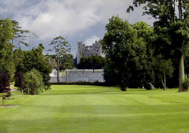 Adare Manor Golf ClubGolf course · 591 yd
 The Golf Course at Adare ManorGolf course · 773 yd
 Franciscan AbbeyArchaeological place · 819 yd
Explorer Tom The Franciscan Abbey is just a fancy backdrop for seagulls who think they own the roof tiles. The monks left centuries…
 Fairy fort / stone ringfort in MondellihyFairy fort / stone ringfort · 1122 yd
Explorer Tom Fairy fort / stone ringfort in Mondellihy was nearly sold for a horse back when people had no idea what they were…
More archaeology and monuments in County Limerick · All of County Limerick

What do you know about this place?Tap to add a comment or ask a question