The historic town of Adare was described in the Urban Survey of Limerick (Bradley et. al. 1989, 1-3) as following: 'The picturesque town of Adare is situated approximately eight miles to the south west of Limerick on the main road to Tralee. It lies to the south of the Maigue river and the placename is thought to derive from Ath Dara "the ford of the oaks". There is no evidence for pre-Norman settlement at Adare. The suggestion has been made that the castle (
LI021-032003-) was built on the site of a pre-Norman ringfort (Rynne 1964) but recent research indicates that it is more likely that this was in fact an Anglo-Norman ringwork castle. Little is known of the history of Adare under the Anglo-Normans but the impressive series of remains indicate that it was a substantial settlement in the thirteenth century. The settlement received the right to hold a fair in 1226 (Sweetman 1876-85, i, no. 1415) and clear evidence of its incorporated borough status is provided by the grant of murage in 1310 (Ir. Rec. Comm. 1829, 42). The town was attacked and burned in 1376 (ibid., 72) it is likely that its decline in importance dates from that time. The high density of important monuments at Adare indicates that it was a sizeable settlement during the thirteenth and fourteenth centuries. It subsequently declined, however, to such a degree that locating the site of the borough poses difficulties. In addition, the village was replanned in the nineteenth century by the earls of Dunraven and much of what had survived, in the form of property boundaries, was swept away at that time. The concentration of the parish church, Augustinian friary (
LI021-032006-) and Trinitarian abbey (
LI021-032008-), south of the river suggests that this was the main centre of settlement but the presence of both the castle and the Franciscan friary (
LI021-032007-) on the north bank suggests that settlement may have existed here also. An important aid in determining the position of the medieval settlement is a map showing the layout of the village before it was replanned by the Dunravens. This indicates that Adare Manor demesne grew at the expense of the village and incorporated parts of the medieval borough site within its estate wall. Evidence that Adare was protected by defences is provided by a grant of murage in 1310 (IR. Rec. Comm. 1829, 42) and by reference to the repair of the town walls in 1376 (ibid., 72). There is no surviving trace of these defences nor can their course be outlined. It is possible that they may have consisted of earthen ramparts with timber palisades.' However Dunraven (1865, 295) described earthworks belonging to the medieval settlement of Adare when he wrote that the, 'road from the Market-place to the Spittle-gate, is the present avenue within the Demesne leading from the Town to the new Stables, which are erected near the words Spittle-gate. The Manor House is situated at the bend of the river in P. Creagh's Burgess land. The marks of the old fence or ditch [
LI021-032013-], extending from Spittle-gate to Castle Plo[ugh]land, are still plainly visible'. Thomas (1992, 2-3) suggested the most likely location for the medieval settlement was north of the river enclosing the parish church (
LI021-032004-), castle (LI021-032003-) and road to the bridge (
LI021-032002-). The 1656 Down Survey parish map of Ballingaddy [NLI, MS 718] shows the layout of the medieval town (before the new town planned by the Dunravens in the 19th century) and indicates that the demesne of the 19th century Adare Manor grew at the expense of this town incorporating parts of the medieval borough within its walls (Purcell 2019, 6; Bradley et al. 1989, 3). McCutcheon (1999, Fig. 15, 55-6) identified the line of the town defences forming the eastern boundary of the historic settlement running through the parkland of Adare Manor. Recent archaeological monitoring of ground works carried out at Adare Manor Hotel and Golf Resort between February 2016 and September 2017 under licence number 16E096 by Avril Purcell revealed significant archaeological deposits dating to the medieval period with a concentration of features in the vicinity of the new entrance [ITM 546885/646489] to the hotel and golf resort in April 2017. These features were excavated by Avril Purcell under licence No. 17E0203 from May to August 2017. The results of her excavations were summarised as following; 'The deposits comprised part of a medieval burgage plot extending east from the N21 and small parts to two adjoining plots to the north and south. Neither the street-fronting portions at the western end of the plots nor the rear portions at the eastern end were identified in the excavation. The main plot was defined by a slot trench (which would have supported a timber fence) to the north and south and these trenches were subject to modifications, partial removal and possibly repair during their life. A large number of pits and slot trenches as well as occasional post holes and build-up layers were the main features within the plots. No definitive structural remains were found but tentative remains were identified. In excess of 5,000 finds were recovered from the excavations and work in associated areas of the site, the vast majority of which were medieval in date. The largest volume of material recovered was ceramics; the pottery was largely locally made ware with a small quantity of imported material including Saintonge ware from SW France. A large quantity of roof or peg tiles was recovered, specifically from certain areas. Metal objects in iron (nails and knife blades), copper alloy (finger rings, a buckle, tweezers and thin strips) and lead (a weight and two perforated weights) were recovered as well as a large amount of iron slag. There was a large quantity of animal bone as well as a small number of spindle whorls. A small number of stone objects were also found including hone stones. In 2018 Transport Infrastructure Ireland (TII) published a lidar survey, undertaken in 2010/11, of the N21 and adjoining land. The survey included the area of the excavation at the entrance to Adare Manor and a large portion of the western side of the historic demesne lands. The survey revealed an extensive pattern of settlement with E-W plots extending from both sides of the N21, remarkably similar in layout to the representation shown on the Down Survey map of 1656. At the eastern end of the settlement a well-defined pair of parallel features extending north towards the River Maigue strongly suggests the presence of a significant defensive bank and ditch. On further analysis this feature is also apparent on a 2005 OSI aerial photograph. The results of the excavation combined with the representation on the TII lidar survey indicate that the 13/14th century town was indeed to the south of the river and continued in this location into the 17th century when it was depicted on the 1656 Down Survey map [NLI, MS 718]. The excavation represents a very small portion of the settlement which given the scale of the deposits recovered appears to have been relatively short lived, extending over just a number of generations' (Purcell 2019, 2). See attached 1656 Down Survey parish map showing the burgage plots of Adare, Courtesy of the National Library of Ireland and Transport Ireland Infrastructure Lidar Image of Adare
Compiled and revised by: Caimin O'Brien
Date of revised upload: 13 January 2019

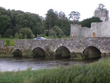 Adare BridgeBridge · 333 yd
 Adare Desmond CastleMedieval castle · 434 yd
 Desmond CastleHeritage attraction · 436 yd
 Desmonds Castle (in ruins)Castle, Anglo-Norman masonry castle · 444 yd
 The RectoryRectory/glebe/vicarage/curate's house · 458 yd
 Adare CourthouseCourt house · 536 yd
 The Golf Course at Adare ManorGolf course · 539 yd
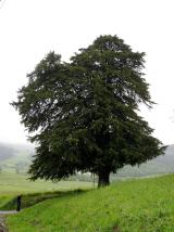 European Yew542 yd
 European Beech592 yd
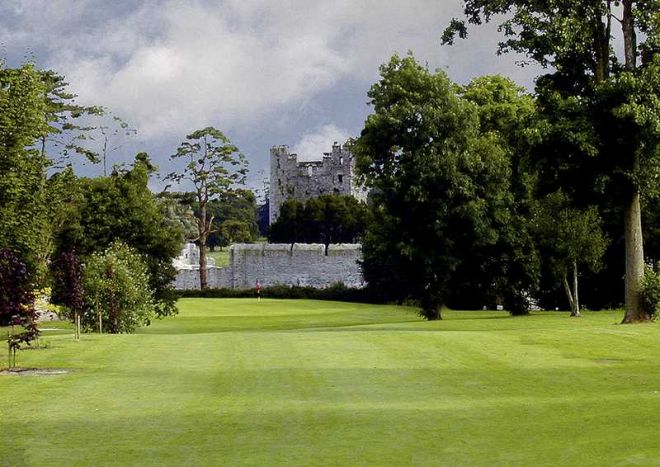 Adare Manor Golf ClubGolf course · 680 yd
 Franciscan AbbeyArchaeological place · 686 yd
 Fairy fort / stone ringfort in MondellihyFairy fort / stone ringfort · 1144 yd

What do you know about this place?Tap to add a comment or ask a question