
What is recorded here
From the National Monuments Service (Archaeological Survey of Ireland) record LI045-112
Places near here
Photo credits
- Maker not stated on source page, evoke.ie
- Maker not stated on source page, commons.wikimedia.org
- National Inventory of Architectural Heritage
- Maker not stated on source page, www.wikidata.org
- Mike Searle, Wikimedia Commons · CC BY-SA 2.0
- Mountcollins GAA club fundraising page / SmartLotto; individual photographer not stated, smartlotto.ie
- Kmcnamee, Wikimedia Commons · CC BY-SA 4.0
- A.-K. D., Wikimedia Commons · CC BY-SA 4.0
 Fairy fort / earthen ringfort in BallydonnellFairy fort / earthen ringfort · 465 yd
Explorer Tom Fairy fort / earthen ringfort in Ballydonnell is split right down the middle by a field boundary, which feels like a…
 Aglish GraveyardCemetery · 970 yd
Explorer Tom Aglish Graveyard has a solid zombie survival plan: hide behind the tallest headstone and hope they trip. The local…
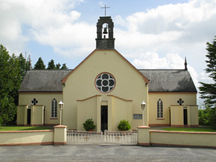 Saint Mary's Catholic ChurchChurch/chapel · 1077 yd
Explorer Tom Saint Mary's Catholic Church says if it won the lotto, it would buy a new bell that goes 'ding' instead of 'dong'. Lord…
 Ahacomusk BridgeBridge · 1.3 mi
Explorer Tom Ahacomusk Bridge in Coolygorman has strict rules: no crows without permission, and you must admire the limestone arches…
 Fairy fort / earthen ringfort in Moanroe MoreFairy fort / earthen ringfort · 1.4 mi
Explorer Tom Fairy fort / earthen ringfort in Moanroe More is playing hide-and-seek with me. A tale from 1846 says an earl built it…
 Lisnafulla BridgeBridge · 1.4 mi
Explorer Tom Lisnafulla Bridge is deeply suspicious of the postman and refuses to let him cross without checking his ID. Its…
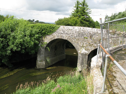 Broken BridgeBridge · 1.9 mi
Explorer Tom Broken Bridge in Cloonpasteen has a superstition that if you cross it at midnight, you’ll find your lost keys somewhere…
 Springfield CastleBawn · 2.1 mi
Explorer Tom This Bawn at Springfield is on a strict diet, giving up all its mystery for Lent. It’s so attached to the house that…
Castle (in ruins), Springfield CastleCastle, tower house · 2.2 miExplorer Tom Springfield Castle in Springfield has the best view of its own confusion since it’s basically a quarry now. The…
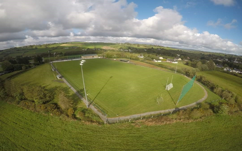 Mountcollins GAA pitchGAA ground · 2.6 mi
 Dromcollogher/Broadford GAA pitchGAA ground · 3.6 mi
 Saint Ite's WellSpring · 3.8 mi
Explorer Tom Saint Ite's Well is a tiny hole covered with a grate, basically complaining to the council about lack of funding for…
More archaeology and monuments in County Limerick · All of County Limerick

What do you know about this place?Tap to add a comment or ask a question