
Places near here
Photo credits
- National Inventory of Architectural Heritage
- Ridiculopathy, Wikimedia Commons · CC BY-SA 4.0
- SirTimmHimself, Wikimedia Commons · CC BY-SA 4.0
- PST Sport, installation contractor; individual aerial photographer not named, pstsport.com
- Ridiculopathy, Wikimedia Commons · CC0
- markjhandel, Wikimedia Commons · CC BY 2.0
- Sharon Loxton, Wikimedia Commons
Explorer Tom Killeen Burial Ground in Annadale is under farm buildings now because giants need parking space. They buried the kids…
 house1683 yd
Explorer Tom This empty house in Lismacfinnin smells like damp socks and regret, according to my expert nose that has never been…
 Ogham stone in Kilcoolaght EastOgham stone · 1.4 mi
Explorer Tom Ogham stone in Kilcoolaght East is wearing its best face while hiding behind those iron railings. Apparently, a church…
 Church in Dromavally (trughanacmy By., Killorglin Ed)Church · 1.4 mi
Explorer Tom Church in Dromavally has an imaginary twin across the sea who is definitely judging its fashion choices. The record…
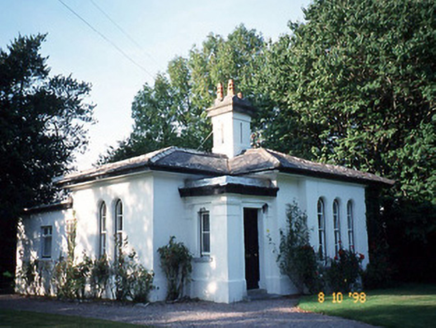 The ReeksGate lodge · 2.4 mi
Explorer Tom The Reeks is an Italianate gate lodge that looks like it got lost looking for the Vikings, or maybe just the main…
CloghfaunaglibbaunMountain / peak · 3.9 miExplorer Tom The builder of Cloghfaunaglibbaun was definitely thinking about lunch when he decided to make this peak exist. It looks…
KnockbrackMountain / peak · 4.2 miExplorer Tom Knockbrack in County Kerry nearly got famous once when a tourist accidentally filmed a goat standing on top of it…
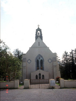 Saint Mary's Catholic ChurchChurch/chapel · 5.0 mi
Explorer Tom Saint Mary's Catholic Church in Coolmagort nearly got famous when a tourist mistook it for a movie set. It’s just a…
 Beaufort GAA pitchGAA ground · 5.2 mi
 Fairy fort / earthen ringfort in Imleach Dhún Séann (tc Na Gleannta)Fairy fort / earthen ringfort · 20 mi
Explorer Tom Fairy fort / earthen ringfort in Imleach Dhún Séann would have 'Finally Resting' carved on its tombstone, right next to…
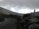 An ChonairViewpoint · 20 mi
Explorer Tom Conor Pass has made a road across the Dingle mountains and then apparently forgotten to leave room for two cars. It…
 Garfinny BridgeHistoric bridge · 20 mi
Explorer Tom Garfinny Bridge has one fine party trick: it is the only bridge in Ireland declared a National Monument. This little…
More archaeology and monuments in County Kerry · All of County Kerry

What do you know about this place?Tap to add a comment or ask a question