
What is recorded here
Current recorded use: Church.
From the Northern Ireland Historic Buildings Record record HB05/09/001
The official record and map point do not grant access. Many historic buildings are privately owned; view them only from public ground unless the owner allows entry.
Places near here
Photo credits
- Colin Park, Geograph · CC BY-SA 2.0
- mauldy, Wikimedia Commons · CC BY-SA 2.0
- Rossographer, Geograph · CC BY-SA 2.0
- Joseph Mischyshyn, Geograph · CC BY-SA 2.0
- Eric Jones, Geograph · CC BY-SA 2.0
- Bryn Holmes, Geograph · CC BY-SA 2.0
- N Chadwick, Wikimedia Commons · CC BY-SA 2.0
- Tony Webster, Wikimedia Commons · CC BY 3.0
- Kenneth Allen, Wikimedia Commons · CC BY-SA 2.0
- Willie Duffin, Geograph · CC BY-SA 2.0
 Dunseverick castle in Feigh Alias DunseverickDunseverick Castle · 1.1 mi
 Dunseverick CastleCastle · 1.2 mi
 DunsevrickCliff · 1.3 mi
 Blue Trail, Giant's CausewayWalking route · 2.1 mi
 Red Trail, Giant's CausewayWalking route · 2.1 mi
 Giant's GateHeritage attraction · 2.2 mi
 White Park BayVisitor information · 2.2 mi
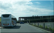 Giant's Causeway Visitor ExperienceMuseum · 2.2 mi
 Causeway HotelHotel · 2.3 mi
 White Park BayBeach / strand · 2.6 mi
 Former National SchoolHall · 2.6 mi
 Runkerry Stand (Bushfoot)Beach / strand · 2.7 mi
More historic places in County Antrim · All of County Antrim
What do you know about this place?