
What is recorded here
Formal path, hard core gravel surfaces, uneven in places, single track in places, 162 steep stone steps ('Shepherd's Steps') with handrail, uneven and with various depths. Please be aware of unfenced cliff edges, high winds, steep steps and rock falls.
- Operator
- National Trust
- Distance
- 3.7
Places near here
Photo credits
- Bryn Holmes, Geograph · CC BY-SA 2.0
- Joseph Mischyshyn, Geograph · CC BY-SA 2.0
- Wikimedia Commons contributor · Public domain
- N Chadwick, Wikimedia Commons · CC BY-SA 2.0
- Bob Embleton, Wikimedia Commons · CC BY-SA 2.0
- Willie Duffin, Geograph · CC BY-SA 2.0
- Kenneth Allen, Geograph · CC BY-SA 2.0
- Colin Park, Geograph · CC BY-SA 2.0
- Richard Webb, Geograph · CC BY-SA 2.0
 Giant's GateHeritage attraction · 203 yd
 Blue Trail, Giant's CausewayWalking route · 261 yd
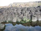 Giant's CausewayHeritage attraction · 304 ydA.p. site: enclosure? in AirdA.p. Site: Enclosure? · 619 ydA.p. site: cropmark (possible enclosure) in AirdA.p. site: cropmark (possible enclosure) · 713 yd
 Causeway HotelHotel · 759 yd
 Runkerry HouseCountry House · 1710 yd
 Runkerry Stand (Bushfoot)Beach / strand · 1.3 miRound cairn: carnkirk castle in CarnkirkRound Cairn: Carnkirk Castle · 1.5 mi
 Runkerry BeachVisitor information · 1.6 mi
 Lissanduff EarthworksNature reserve · 1.8 mi
 Portballintrae BeachBeach / strand · 2.1 mi
More walking routes in County Antrim · All of County Antrim
What do you know about this place?