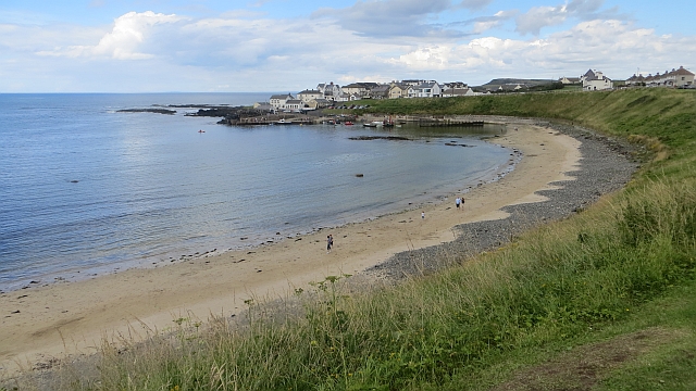
What is recorded here
Portballintrae Beach is recorded as a beach / strand in County Antrim.
From OpenStreetMap (© OpenStreetMap contributors) w298903541
Places near here
Photo credits
- Colin Park, Geograph · CC BY-SA 2.0
- Kenneth Allen, Geograph · CC BY-SA 2.0
- Willie Duffin, Geograph · CC BY-SA 2.0
- Bob Embleton, Wikimedia Commons · CC BY-SA 2.0
- Mike Faherty, Wikimedia Commons · CC BY-SA 2.0
- Osioni, Wikimedia Commons · Public domain
- N Chadwick, Geograph · CC BY-SA 2.0
- Dr Neil Clifton, Wikimedia Commons · CC BY-SA 2.0
- Joseph Mischyshyn, Geograph · CC BY-SA 2.0
- Eric Jones, Geograph · CC BY-SA 2.0
Enclosure (rath?; O.S. memoir site) in Ballintrae; GortcappleEnclosure (rath? · 340 yd Lissanduff EarthworksNature reserve · 630 ydRunkerry BeachVisitor information · 959 ydA.p. site: cropmark of possible enclosure in BoneyclassaghA.p. Site: Cropmark of Possible Enclosure · 1232 ydRunkerry Stand (Bushfoot)Beach / strand · 1347 ydRunkerry HouseCountry House · 1.1 miClock Tower1.2 miDunluce CastleHeritage attraction · 1.3 miMulti-period CastleMulti-period castle, C15th-POST-MEDIEVAL, with rock-cut Man-made underground passage: dunluce castle · 1.3 miOld Bushmills DistilleryHeritage attraction · 1.5 miBlue Trail, Giant's CausewayWalking route · 1.9 miRed Trail, Giant's CausewayWalking route · 2.1 mi
 Lissanduff EarthworksNature reserve · 630 yd
 Runkerry BeachVisitor information · 959 ydA.p. site: cropmark of possible enclosure in BoneyclassaghA.p. Site: Cropmark of Possible Enclosure · 1232 yd
 Runkerry Stand (Bushfoot)Beach / strand · 1347 yd
 Runkerry HouseCountry House · 1.1 mi
 Clock Tower1.2 mi
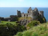 Dunluce CastleHeritage attraction · 1.3 mi
 Multi-period CastleMulti-period castle, C15th-POST-MEDIEVAL, with rock-cut Man-made underground passage: dunluce castle · 1.3 mi
 Old Bushmills DistilleryHeritage attraction · 1.5 mi
 Blue Trail, Giant's CausewayWalking route · 1.9 mi
 Red Trail, Giant's CausewayWalking route · 2.1 mi
More beaches and strands in County Antrim · All of County Antrim
What do you know about this place?