
What is recorded here
Internal diam. c. 18m NNW-SSW, c. 17m WNW--ESE. A subcircular area enclosed now by a collapsed stone wall. The outer facing of this is visible in patches all the way round but the inner facing survives only on the W side. The thickness of the wall here is c. 1.45m. The SW section of the collapse is noticeably larger…
Read the whole record
From the National Monuments Service (Archaeological Survey of Ireland) record DG080-021002
Places near here
Photo credits
- Nigel Callaghan, Wikimedia Commons · CC BY-SA 2.0
- Maker not stated on source page, en.wikipedia.org
- Maker not stated on source page, www.deezer.com
- Einaz80, Wikimedia Commons · CC BY-SA 4.0
- Gerald England, Wikimedia Commons
- Gordon Hatton, Wikimedia Commons · CC BY-SA 2.0
- Maker not stated on source page, www.livescience.com
- Maker not stated on source page, fi.pinterest.com
- Donegal Daily (publisher); individual photographer not stated, www.donegaldaily.com
- Maker not stated on source page, www.tripadvisor.com.au
- Ardfern, Wikimedia Commons · CC BY-SA 3.0
- John M, Geograph · CC BY-SA 2.0
 Dún Ailt Promontory FortPromontory fort, coastal · 40 yd
Explorer Tom Dún Ailt Promontory Fort cuts off a neck of land between two inlets, leaving you with excellent views down…
 Dún Ailt Cairn and Cross-Marked SlabCairn, unclassified · 1001 yd
Explorer Tom Dún Ailt Cairn and Cross-Marked Slab is a weird little garden oddity overlooking Glen Bay. You get three different…
 An Trá Bheag (Trá Bheag an Ghleanna)Beach / strand · 1131 yd
Explorer Tom An Trá Bheag means the small beach, and this curve of sand by Gleann Cholm Cille lives up to the name. The Folk…
 Glencolmcille Folk VillageMuseum · 1412 yd
Explorer Tom Glencolmcille Folk Village looks like a handful of Donegal cottages stopped for a chat above the sea and forgot to go…
 Trá an GhleannaBeach / strand · 1756 yd
Explorer Tom Trá an Ghleanna meets the Atlantic where the Glencolmcille valley finally runs out of land, and Donegal has placed Glen…
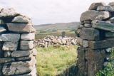 St Columba's CellPenitential station · 1.0 mi
Explorer Tom St Columba's Cell in Garbhros has an opinion from the local sheep that says 'it’s a bit dark.' It’s a small dry-stone…
 Cairn beside St Columba's CellCairn, unclassified · 1.1 mi
Explorer Tom Cairn beside St Columba's Cell is waiting for its full story to be uploaded, but the name alone gives me a jolt.…
 Church in BíofánChurch · 1.1 mi
Explorer Tom Church in Bíofán is a ruined chapel inside a stone-walled enclosure. In one corner, the record names two horizontal…
 Páirc na nGael, Naomh ColumbaGAA ground · 1.1 mi
 Cafe BlastaCafé · 1.4 mi
Explorer Tom Cafe Blasta in County Donegal took approximately four hundred cups of tea to build its walls, meaning every sip you…
 Rossan PointHeadland · 1.4 mi
Explorer Tom Rossan Point has the sort of name that sounds ready to command a ship, and southwestern Donegal supplies the scenery to…
 Biddy's PubPub · 1.4 mi
Explorer Tom Biddy's Pub sits at the crossroads in Glencolumcille, where the music stops and the shouting starts. It claims to be…
More archaeology and monuments in County Donegal · All of County Donegal

What do you know about this place?Tap to add a comment or ask a question