
What is recorded here
From OpenStreetMap (© OpenStreetMap contributors) n2405430038
Places near here
Photo credits
- National Inventory of Architectural Heritage
- Dean Molyneaux, Wikimedia Commons · CC BY-SA 2.0
- unknown author, Wikimedia Commons · Public domain
- Shane Killen, Wikimedia Commons · CC BY-SA 2.0
- Kenneth Allen, Wikimedia Commons · CC BY-SA 2.0
- Eric Jones, Geograph · CC BY-SA 2.0
- Eric Jones, Geograph · Creative Commons Attribution-ShareAlike 2.0
- Eric Jones, Wikimedia Commons · CC BY-SA 2.0
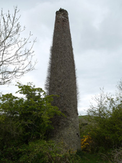 chimney875 yd
Explorer Tom Chimney in Cornalough stands alone like a lonely finger pointing at the sky, all smoky history and no house to show for it. It thinks the road leading to it is just a very long detour. Take a mate and
Fincarn HillMountain / peak · 1362 yd Thornford HouseStore/warehouse · 1507 yd
Explorer Tom Thornford House in Aghadreenan hates when people call it a house because it’s actually a grain store pretending to be modest. It’s got red brick details that are basically shouting for attention. Bring your nan, she'll know m
Whites IslandIslet · 2.1 mi Blaney CastleCastle · 2.6 mi
 Castle BlayneyHouse, fortified house · 2.6 miThe CrescentMemorial · 2.6 mi
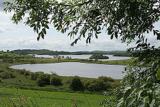 Lough MucknoLake and park landscape · 2.7 mi
Explorer Tom Lough Muckno was the original escape plan for someone who really needed a long drink by the water’s edge. It sits there judging your swimming technique from the safety of its deep, mysterious depths without ever saying a word to you. Tell your mates you found it first.
 Mindszenty ParkPark · 2.9 mi
 Crane IslandIsland · 3.0 mi
 Crannog in lisleitrim lough in Kiltybane or LisleitrimCrannog in Lisleitrim Lough · 5.4 mi
Explorer Tom Crannog in Lisleitrim lough in Kiltybane Or Lisleitrim is an unusually large wooded crannog, which means it’s basically a tree house for giants. The builder was probably thinking about snacks when they built this. Have a chat with it; nobody's watching from the shore.
 Lisleitrim FortArchaeological place · 5.8 mi
Explorer Tom Lisleitrim Fort offers a quiet spot to ponder the past, nestled within the rolling landscapes of County Armagh.
More mountains and hills in County Monaghan · All of County Monaghan

What do you know about this place?Tap to add a comment or ask a question