What is recorded here
From OpenStreetMap (© OpenStreetMap contributors) n11723468243
Places near here
Picture notes
- Eric Jones, Geograph · Creative Commons Attribution-ShareAlike 2.0
- Kenneth Allen, Geograph · CC BY-SA 2.0
- Computer-made picture. It does not show this playground.
- Computer-made picture. It does not show this garden.
- Deadstar, Wikimedia Commons · CC BY-SA 4.0
- Eric Jones, Geograph · CC BY-SA 2.0
- Pamela Norrington, Wikimedia Commons · CC BY-SA 2.0
- Sitomon, Wikimedia Commons · CC BY-SA 2.0
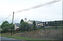 Church of the Immaculate ConceptionChurch/chapel · 472 yd
Explorer Tom The Church of the Immaculate Conception features a striking copper roof and Classical revival pediment, standing tall in Drumauna.
 Drung Church of Ireland ChurchChurch/chapel · 1081 yd
Explorer Tom Drung Church has castellated ashlar parapets and octagonal pinnacled corner turrets that make it look like a small fortress.
 Giant's GraveArchaeological place · 1457 yd
Explorer Tom Giant's Grave in County Cavan feels like a secret garden, waiting for you to imagine who slept here.
CastleCastle, unclassified · 1.3 miExplorer Tom A castle was marked here on Petty's map, but the site is levelled now; five horse skulls found under Lislin House suggest a very spooky foundation ritual.
 Bunnoe PlaygroundChildren's playground · 1.8 miComputer-made picture. It does not show this playground.
Explorer Tom Bunnoe Playground in County Cavan is likely a hub of chaotic joy, with slides that make time stand still for kids.
Embanked enclosureBawn · 1.9 miExplorer Tom This embanked enclosure in Pottle East looks like a fort on old maps, with a raised rectangular area; maybe it’s the castle depicted at Donmory on the Civil Survey.
DernaskeaghMountain / peak · 2.2 miExplorer Tom Dernaskeagh is featured on Wikimedia Commons for County Cavan, so if you can’t find it, just look at the pictures.
 Tullyvin Walled GardenGarden · 3.3 miComputer-made picture. It does not show this garden.
Explorer Tom Tullyvin Walled Garden in County Cavan might be guarding ancient secrets about why the local apples taste so suspiciously sweet and magical.
 Fin Mc Cools FingersStone row · 3.5 mi
Explorer Tom Five stones graded by height stand in a clearing, known locally as Fin McCool’s Fingers, pointing towards the ridge.
 Cormeen Glebe ForestForest · 4.2 mi
Explorer Tom Cormeen Glebe Forest near Clifferna, County Cavan, feels like a peaceful retreat; perhaps a farmhouse ghost is waving from the trees.
 Cabragh RingfortArchaeological place · 4.5 mi
Explorer Tom Cabragh Ringfort is recorded as an archaeological place in County Cavan, likely a circular dwelling spot surrounded by banks that protected its ancient residents.
 European Yew5.4 mi
Explorer Tom A resilient European Yew in County Cavan, perhaps ancient and slow-growing, with dark green needles that stay lush through the harshest winters.
More mountains and hills in County Cavan · All of County Cavan
What do you know about this place?Tap to add a comment or ask a question