
What is recorded here
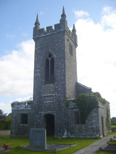
Roadway consisting of a sunken way (Wth 10m, approx. L. ) flanked on either side by a low earth and stone bank leading up to W entrance of early Christian ecclesiastical enclosure (LI028-066001-) containing the remains of Clonagh Church (LI028-066002-) and graveyard (LI028-066003-). The dating of this trackway is uncertain and the route of the roadway has been mapped out on the revised OS 6-inch map.
Compiled by: Caimin O'Brien
Date of upload: 04 march 2019
See attached ASI aerial photographs ASIAP – taken on 04/03/2006.
The monument record does not grant public access. Check the route and ask the landowner before entering private land.
- What survives
- Recorded monument
Places near here
 Ecclesiastical enclosure in ClonaghEcclesiastical enclosure · 206 yd
 St. Kierans WellHoly well · 367 yd
 St. Kieran's WellSpring · 370 yd
 bridgebridge · 644 yd
 Kilscannell Churchchurch/chapel · 1464 yd
 Bawn in Lisnacullia (connello Lower By.)Bawn · 1480 yd
 TobernablahySpring · 1.1 mi
 Castle MatrixCastle, tower house · 2.0 mi
 European ashEuropean ash · 2.9 mi
 Limerick GreenwayWalking route · 7.1 mi
 Gammarel PointHeadland · 8.1 mi
 Tummera LittleIslet · 8.6 mi
Other information
Photo: Credit not shown in the picture search · Rights wording not checked; contact us if this picture should be removed