
What is recorded here
From OpenStreetMap (© OpenStreetMap contributors) w530885080
Places near here
Photo credits
- Eric Jones, Wikimedia Commons · CC BY-SA 2.0
- Maker not stated on source page, www.pinterest.com
- Eric Jones, Geograph · CC BY-SA 2.0
- Maker not stated on source page, en.wikipedia.org
- Silverbridge Harps GAC; photographer not named, silverbridgeharps.club
- Maker not stated on source page, www.stravaiging.com
- Armagh City, Banbridge and Craigavon Borough Council (publisher; photographer not named), www.armaghbanbridgecraigavon.gov.uk
- DagosNavy, Wikimedia Commons · CC BY-SA 3.0
- Maker not stated on source page, ru.pinterest.com
 Ummeracam BridgeBridge · 1038 yd
Explorer Tom Ummeracam Bridge is in a massive drama with the nearest tree because the tree keeps dropping leaves on its roof, which…
 Standing Stone: Cloghfin; Calliagh Berras Stone & the White Stone of Watching in TullynavallStanding Stone: Cloghfin · 1359 yd
Explorer Tom Standing Stone: Cloghfin, Calliagh Berras Stone & the White Stone of Watching in Tullynavall has three names because it…
 Irish Hunger StrikersMemorial · 1.0 mi
Explorer Tom Irish Hunger Strikers memorial at New Roads Crossroads is a rock that stands firm because it refuses to take the…
 Historic Settlement Silver Bridge in LegmoylinHistoric Settlement Silver Bridge · 1.0 mi
Explorer Tom Historic Settlement Silver Bridge in Legmoylin sounds like something you’d find at a high-end estate agent. A…
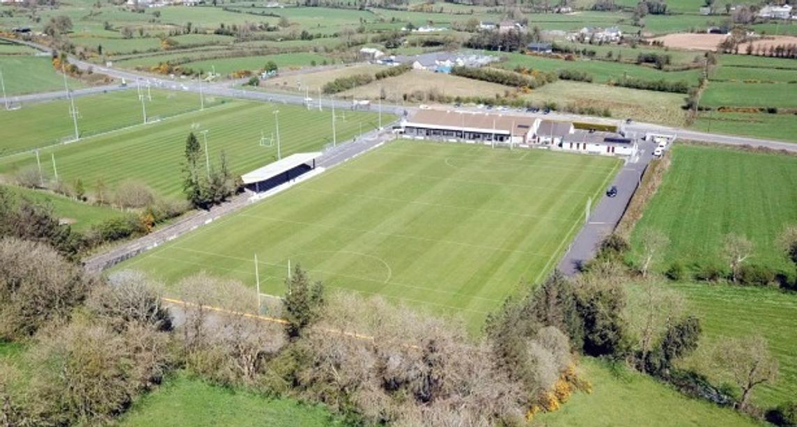 Keeley Park, Silverbridge HarpsGAA ground · 1.2 mi
 Multiple cist cairn: the moate in Dorsy (cavan O'hanlon); Dorsy or RoxboroughMultiple Cist Cairn: the Moate · 1.6 mi
Explorer Tom The Moate in Dorsy is a multiple cist cairn that’s been sitting there since the Bronze Age. It’s had plenty of time to…
 Aughanduff Upper MountainMountain / peak · 1.6 mi
Explorer Tom Aughanduff Upper Mountain in County Armagh wants its tombstone to say 'Resting, but still judging your hiking boots'…
 Páirc Pádraig, St. Patrick's GAA, CullyhannaGAA ground · 1.8 mi
 Operation ConservationMilitary operation · 2.0 mi
Explorer Tom Operation Conservation in County Armagh is just the weather having a long, bitter grudge against the military and…
 Battle of Newry RoadBattle · 2.7 mi
Explorer Tom Battle of Newry Road in County Armagh gave up chocolate for Lent because it was stressed about the whole military…
 SlievenacappelMountain / peak · 2.7 mi
Explorer Tom Slievenacappel refuses to fall down because it thinks gravity is just a suggestion and it hasn’t agreed to the terms…
 Tower-house & bawn: glasdrumman castle in GlasdrummanTower-house & Bawn: Glasdrumman Castle · 2.9 mi
Explorer Tom Tower-house & bawn: Glasdrumman castle in Glasdrumman has a retirement plan involving becoming a very expensive garden…
More archaeology and monuments in County Armagh · All of County Armagh

What do you know about this place?Tap to add a comment or ask a question