What is recorded here
Headland projecting SW from Cape Clear. Westropp (1915, 253) noted remains of fosse with stone wall on seaward side at neck of promontory. He also noted remains of circular hut site (CO153-014001-) in interior. The promontory is now a long, narrow spine of rock, with no soil cover; eroding rapidly by sea. No visible trace of wall or fosse.
From the National Monuments Service (Archaeological Survey of Ireland) record CO153-014
This remains an important historical record, but the official description says the monument is no longer visible or has been destroyed. The monument record does not grant public access. Check the route and ask the landowner before entering private land.
- What survives
- No visible remains or recorded as destroyed
Places near here
Photo credits
- Becky Williamson, Geograph · CC BY-SA 2.0
- National Inventory of Architectural Heritage
- Chris06, Wikimedia Commons · CC BY-SA 4.0
- Colin Park, Geograph · CC BY-SA 2.0
- pl:Wikipedysta:A., Wikimedia Commons · CC BY 2.5
- Anthony Patterson from Cork, Ireland, Wikimedia Commons · CC BY 2.0
- Richard Webb, Wikimedia Commons · CC BY-SA 2.0
Promontory fortPromontory fort, coastal · 178 ydField boundary in Baile Iarthach Theas (cléire)Field boundary · 205 yd Cape ClearHeadland · 855 ydfarm house996 ydfarm house1169 ydO'Driscoll CastleCastle · 1626 ydDoonanore Castle (in Ruins)Castle, tower house · 1632 ydCléireIsland · 1.4 miFastnet LighthouseLighthouse · 4.4 miWhite StrandBeach / strand · 4.9 miLong IslandIsland · 5.1 miSilver StrandBeach / strand · 5.3 mi
 Cape ClearHeadland · 855 yd
 farm house996 yd
 farm house1169 yd
 O'Driscoll CastleCastle · 1626 yd
 Doonanore Castle (in Ruins)Castle, tower house · 1632 yd
 CléireIsland · 1.4 mi
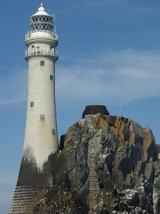 Fastnet LighthouseLighthouse · 4.4 mi
 White StrandBeach / strand · 4.9 mi
 Long IslandIsland · 5.1 mi
 Silver StrandBeach / strand · 5.3 mi
More archaeology and monuments in County Cork · All of County Cork
What do you know about this place?