DDiscover AloneMapAbout

Donore House

House, 17th century

The monument record does not grant public access. Check the route and ask the landowner before entering private land.

What do you know about this place?Tap to add a comment or ask a question

What you write will be public.

What is recorded here

The precise location of a possible early 17th century house described in the terrier of the Down Survey has not been identified. The terrier of the 1659 Down Survey map of Multyfarnham parish stated that 'There is likewise Donowre upon the side of the Lough Derevarrah a very Handsome English like House with an orchard…

Read the whole record
The precise location of a possible early 17th century house described in the terrier of the Down Survey has not been identified. The terrier of the 1659 Down Survey map of Multyfarnham parish stated that 'There is likewise Donowre upon the side of the Lough Derevarrah a very Handsome English like House with an orchard adjoining to it well planted with good Fruit Trees' (NLI MS 723-4). In 1640 this house belonged to Andrew Nugent described in the Down Survey as an 'Irish papist' and owner of 423 acres of profitable land in Donore (ibid.). Andrew Nugent of Donore had a special livery of his estate dating 3rd April 1629. In 1641 he was appointed a captain in the Irish army, and commanded one hundred men at Kilsoghlin, to defend that place against the English, for which he was indicted (Burke 1832, 248-9). This house may have been built on the site of a medieval castle belonging to his father Richard Nugent. In 1613 an inquisition into the property of the deceased Richard Nugent of Donore recorded that he possessed 1 castle & 240 acres of land in the townland of Donowre which formed part of the manor of Multyfarnham (Cal. inq. post mortem, 11 Jas 1). This house is shown standing close to the shoreline of Lough Derravaragh in the NW quadrant of Donore townland on the 1659 Down Survey map of Multyfarnham parish. On this map the building is depicted as a single pile two storey high house aligned E-W with attic and gable ended chimney stacks on both gables rising above the roofline. The front door is depicted in the centre of the S wall of the house with attic light in E gable. The 17th century orchard is depicted in an area to the E of the house in the area where the present walled garden of Donore House is located. 18th century Donore House depicted on the 1837 ed. OS 6-inch map is located in the same general region as the building depicted on the Down Survey map. The 'Handsome English like House' belonging to Andrew Nugent may have been located in the grounds of Donore House although no trace of any 17th century house has been identified in this area. It is possible that the building described in the Down Survey may have been located in the surrounding fields around the present country house. Alternatively the 'English style' house may have been levelled when the present Donore House was built. Donore House described in 1826 as ‘a square building, without wings, and at one side is a gateway, of rich and beautiful architecture, leading to offices which appear never to have been finished’ (Greendrake 1826, 24). Donore House was described by the National Inventory of Architectural Heritage as following; 'Complex of multi-bay two-storey outbuildings/stables arranged around central courtyard, built c.1790. Ancillary buildings located to the north and to the west having remains of former walled garden. Now ruinous and out of use. Originally associated with Donore House (demolished c.1970). Cut stone plaque, probably the coat of arms of the Nugent Family, to the east gable of range to south range. Donore House was a three-storey late eighteenth Georgian block, demolished, c. 1970, after falling into a state of disrepair after the Land Commission divided the lands in the 1960s' (www.buildingsofireland.ie).

From the National Monuments Service (Archaeological Survey of Ireland) record WM007-037

Places near here

Photo credits
  • Maker not stated on source page, www.irishcentral.com
  • Oliver Dixon, Wikimedia Commons · CC BY-SA 2.0
  • Maker not stated on source page, www.pinterest.com
  • National Inventory of Architectural Heritage
  • Maker not stated on source page, chimptrips.com
  • Kath O’Grady Reilly and John McCauley credited collectively for the article photographs; this frame is not individually attributed, www.westmeathexaminer.ie
  • Maker not stated on source page, ru.pinterest.com
  • Maker not stated on source page, commons.wikimedia.org
CastleCastle, unclassified · 748 yd

Explorer Tom Donore Castle smells like old cheese and regret, according to Tom, who swears he can smell it from a mile away even…

Children of Lir: Lough DerravaraghLegend location · 1330 yd

Explorer Tom Children of Lir: Lough Derravaragh starts with four children becoming swans because Aoife could not bear sharing the…

Fairy fort / earthen ringfort in Ballynakill (corkaree By.)Fairy fort / earthen ringfort · 1559 yd

Explorer Tom Fairy fort / earthen ringfort in Ballynakill has been levelled so flat you need a satellite to see the ghost of it.…

The AbbeyFriary · 1.4 mi

Explorer Tom The Abbey in Abbeyland had a time when a fox took charge of the cloisters after the English burned down the original…

BallinacloonOutbuilding · 1.4 mi

Explorer Tom Ballinacloon is standing alone like a lonely uncle who lost his family in a property scandal around 1930. It’s…
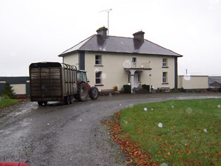
Soho HouseHouse · 1.5 mi

Explorer Tom Soho House in Cloondalin is an early nineteenth-century beauty with an ornate cast-iron porch that looks like it…

Bridge in Multyfarnham,rathganny,multyfarnham or Fearbranagh,ballindurrowBridge · 1.5 mi

Explorer Tom Bridge in Multyfarnham, Rathganny, Multyfarnham OR Fearbranagh, Ballindurrow is obsessed with the tune 'Swing Low…
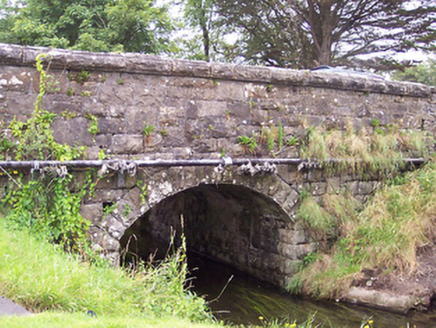
bridge1.5 mi

Explorer Tom Bridge in Ballindurrow caused such a huge argument in the parish that people still whisper about it. Built of…

Multyfarnham GAA pitchGAA ground · 1.6 miMortimers CastleCastle, unclassified · 1.7 mi

Explorer Tom Mortimers Castle thinks the road leading to it is an insult to its royal heritage and dignity. It’s a castle that’s…

The Rock CemeteryCemetery · 1.7 mi

Explorer Tom The Rock Cemetery was built on a bargain where someone traded a sheep for a plot of prime real estate, and the sheep…

Site of Church & Grave YardGraveyard · 1.9 mi

Explorer Tom Site of Church & graveyard in Kiltoom is right next to a holy well and the Yellow River, which makes it feel like a…

More historic places in County Westmeath · All of County Westmeath

Add to this placeAdd a picture Add a detailed tip Add a story

Explore the map1,095,414 places to discover

Next place · or swipeCastle