What is recorded here
Located within the S half of an ecclesiastical enclosure (DG084-001001-). This roughly oval or oblong area (34m NE−SW; c. 27m NW−SE) is defined by low sod-covered walls footings, in parts reduced to a slight scarp. A drystone wall on NE−SW axis subdivides the interior to W of centre. This wall marks off the W third of the enclosure, which serves as a graveyard (DG084-001002-), in which an altar (DG084-001008-) and three penitential cairns (DG084-001005-; DG084-001006-; DG084-001007-) are located.
Located within the S half of an ecclesiastical enclosure (DG084-001001-). This roughly oval or oblong area (34m NE−SW; c. 27m NW−SE) is defined by low sod-covered walls footings, in parts reduced to a slight scarp. A drystone wall on NE−SW axis subdivides the interior to W of centre. This wall marks off the W third of the enclosure, which serves as a graveyard (DG084-001002-), in which an altar (DG084-001008-)…
From the National Monuments Service (Archaeological Survey of Ireland) record DG084-001011
The monument record does not grant public access. Check the route and ask the landowner before entering private land.
- What survives
- Recorded monument
Places near here
Photo credits
- louise price, Wikimedia Commons · CC BY-SA 2.0
- louise price, Geograph · CC BY-SA 2.0
- National Inventory of Architectural Heritage
- louise price, Geograph · Creative Commons Attribution-ShareAlike 2.0
- Kenneth Allen, Geograph · CC BY-SA 2.0
- Ronnie Nijboer, Wikimedia Commons · CC0
- EecherplazGinkgo06.jpg : Cayambe derivative work: Ginkgotree ( talk ), Wikimedia Commons · CC BY-SA 3.0
 Disert GraveyardGraveyard · 12 yd
 Dolmen at DisertPublicly named tomb or grave · 54 yd
 CarnaweenMountain / peak · 1.2 mi
 Cloghmeen HillMountain / peak · 1.5 mi
 Tullytrasna Standing StonePublicly named standing stone · 2.4 mi
 Church of the Holy RedeemerChurch/chapel · 2.8 mi
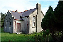 Lettermore National SchoolSchool · 2.8 mi
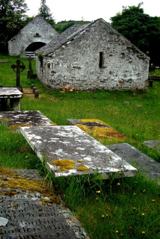 Inishkeel Graveyard near GlentiesGraveyard · 4.8 mi
 St. Connell's Museum and Heritage CentreMuseum · 5.7 mi
 MurvaghOfficial bathing water · 8.9 mi
 Wych Elm9.0 mi
 Ginkgo9.9 mi
More archaeology and monuments in County Donegal · All of County Donegal
What do you know about this place?