
What is recorded here
From the National Monuments Service (Archaeological Survey of Ireland) record DU022-069
Places near here
Photo credits
- National Inventory of Architectural Heritage
- Gabriel Beranger (ca.1729-1817), Wikimedia Commons · Public domain
- Wikimedia Commons contributor · Public domain
- Maker not stated on source page, commons.wikimedia.org
- Discover Ireland; photographer not stated, Discover Ireland
- Maker not stated on source page, www.flickr.com
- Maker not stated on source page, www.tripadvisor.ie
 Fern HillGate lodge · 454 yd
Explorer Tom Fern Hill is a gate lodge from 1812 that thinks it’s too important to let people in easily. It’s got high gables and…
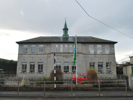 Saint Mary's National SchoolSchool · 654 yd
Explorer Tom Saint Mary's National School in Balally is a 1936 T-plan building with a 'bas-relief' breakfront. It replaced a gaunt…
 Kilgobbin Castle (in ruins)Castle, tower house · 674 yd
Explorer Tom Kilgobbin Castle in Kilgobbin is an impressive granite tower house that was nearly sold for a horse in some wild tale I…
 Kilgobbin CastleCastle · 675 yd
Explorer Tom Kilgobbin Castle in County Dublin has got an 1834 drawing hanging around, which makes it feel like a real old-timer.…
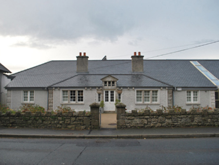 Sandyford Carnegie Free LibraryLibrary/archive · 680 yd
Explorer Tom Sandyford Carnegie Free Library is judging your reading habits while pretending to be just another brick in the wall of…
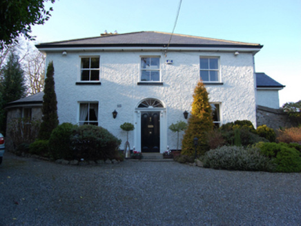 Castle LodgeHouse · 742 yd
Explorer Tom Castle Lodge on Kilgobbin Road, County Dublin, looks like a house that went to university and came back with a degree…
 Linear earthwork in KilgobbinLinear earthwork · 773 yd
Explorer Tom Linear earthwork in Kilgobbin is a lane that used to be a bank, which then became a ditch, now it’s just a path. It’s…
 Bullaun stone in KilgobbinBullaun stone · 779 yd
Explorer Tom Bullaun stone in Kilgobbin is actually the base of a 12th-century high cross. It's got a shallow basin cut into its…
 Mapped graveyardGraveyard · 831 yd
Explorer Tom Mapped graveyard in County Dublin has had so many name changes it’s got more aliases than a spy in a bad thriller. I…
 Explorium: National Sport and Science CentreMuseum · 1275 yd
Explorer Tom Explorium on Blackglen Road in Sandyford has a splendid answer to anyone who says science should be studied quietly…
 Graveyard in KilgobbinGraveyard · 1.1 mi
Explorer Tom Graveyard in Kilgobbin has been heavily landscaped for a golf course, which is a bold move. It's just a levelled area…
 Ticknock WoodForest · 1.2 mi
Explorer Tom Ticknock Wood handles nosey neighbours by growing thorns directly out of the ground where they usually park their cars…
More archaeology and monuments in County Dublin · All of County Dublin

What do you know about this place?Tap to add a comment or ask a question