What is recorded here
Lissard House and the claimed ancient boundary still occupy the same county, but the visible facts refuse the claim. The land office recorded a sub-circular raised area in 1911, then people removed the very shape that would have answered the debate. Patrick F. O'Donovan preserved the admission that design, not antiquity, may have made the feature. Forget the mythical date and judge what the characters did to the evidence.
On a prominent rise in pasture, within the demesne of 'Lissard House'. Not indicated on the OS 6-inch map (1837). Represented as a sub-circular raised area on the OS 25-inch plan (1911). This has been levelled and there are no remains visible at ground level. It is very likely that this was a designed landscape feature.
Compiled by: Patrick F. O'Donovan
Date of upload: 26 August 2011
The monument record does not grant public access. Check the route and ask the landowner before entering private land.
- What survives
- Recorded monument
Places near here
 RuinsCastle, unclassified · 229 yd
 Church in FirmountChurch · 466 yd
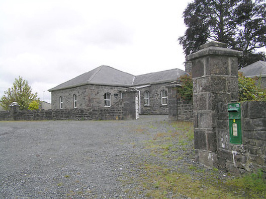 Lissard Housegates/railings/walls · 470 yd
 Moat & FortCastle, motte and bailey · 476 yd
 BarrowBarrow, embanked barrow · 1147 yd
 Enclosure in CartronreaghEnclosure · 1210 yd
 Ballinalee Forest WalkForest · 3.7 mi
 Bully's Acregraveyard/cemetery, unknown · 4.1 mi
 Granard MotteMotte-and-bailey castle remains · 5.4 mi
 1798 Monumentmonument · 5.5 mi
 CartronfreeMountain / peak · 8.4 mi
 ToomeMountain / peak · 9.2 mi