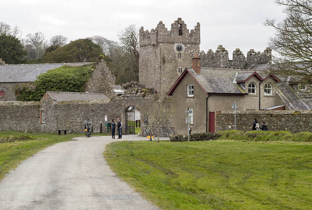
What is recorded here
Recorded protection: Scheduled.
From the Northern Ireland Sites and Monuments Record record DOW031:071
The monument record does not grant public access. Check the route and ask the landowner before entering private land.
- What survives
- Recorded monument
Places near here
 Tower-house: old castle ward in CastlewardTower-house: Old Castle Ward · 291 yd
 Castle WardCastle · 291 yd
 North LodgeGates/ Screens/ Lodges · 417 yd
 Boat House428 yd
 Stone quay in CastlewardStone Quay · 448 yd
 Quay in CastlewardQuay · 603 yd
 Tower-house and bawn: audley's castle in CastlewardTower-house and Bawn: Audley's Castle · 763 yd
 Audley's CastleHeritage attraction · 777 yd
 Audleystown WoodWood · 802 yd
 Cranes' CornerHeadland · 1236 yd
 Castle Ward ForestForest · 1298 yd
 Chapel IslandIslet · 1.0 mi
Pictures: Eric Jones, Geograph · CC BY-SA 2.0; Ardfern, Wikimedia Commons · CC BY-SA 3.0; Eric Jones, Wikimedia Commons · CC BY-SA 2.0; Eric Jones, Geograph · Creative Commons Attribution-ShareAlike 2.0; Des Colhoun, Geograph · CC BY-SA 2.0; Caroline Devlin, Wikimedia Commons · CC BY-SA 2.0; Albert Bridge, Geograph · CC BY-SA 2.0; Paul Taunton, Geograph · CC BY-SA 2.0; Rossographer, Geograph · CC BY-SA 2.0
More castles and forts in County Down · All of County Down
What do you know about this place?