What is recorded here
Daybreak is a steamship in Dumfries and Galloway, Scotland.
From the Historic Environment Scotland record 323118
The historic-place record does not grant public access. Check current conditions and ownership before entering land or a building.
Places near here
Photo credits
- Aubrey Dale, Wikimedia Commons · CC BY-SA 2.0
- Eric Jones, Geograph · CC BY-SA 2.0
- Oliver Dixon, Geograph · CC BY-SA 2.0
- Oliver Dixon, Wikimedia Commons · CC BY-SA 2.0
- Rossographer, Geograph · CC BY-SA 2.0
- Rossographer, Wikimedia Commons · CC BY-SA 2.0
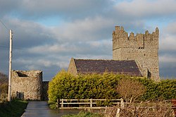 Kirkistown CastleCastle · 5.0 mi
 Kearney Coastal Walk, KearneyWalking route · 5.1 mi
 Burial IslandIslet · 5.7 mi
 Burr PointHeadland · 5.8 mi
 Quintin CastleCastle · 6.5 mi
 Quintin CastleCountry House · 6.5 mi
 Windmill HillMountain / peak · 6.6 mi
 Millin Bay CairnArchaeological place · 7.0 mi
 Glastry Presbyterian ChurchChurch · 7.1 mi
 Two Early Christian Churches: Churches of Dere in DerryTwo Early Christian Churches: Churches of Dere · 7.1 mi
 Corrog WoodWood · 7.7 mi
 Medieval Church & Graveyard: Ballytrustan; Thrustaynistone in BallytrustanMedieval Church & Graveyard: Ballytrustan · 7.8 mi
More wrecks and historic events in Dumfries and Galloway · All of Dumfries and Galloway
What do you know about this place?