Places near here
Photo credits
- JP, Geograph · Creative Commons Attribution-ShareAlike 2.0
- Britishfinance, Wikimedia Commons · CC BY-SA 4.0
- Miguel Angel Masegosa Martínez, Wikimedia Commons · CC BY 2.0
- Vicente Fernández Rioja, Wikimedia Commons · CC BY-SA 4.0
- Marathon, Wikimedia Commons · CC BY-SA 2.0
- Sheila1988, Wikimedia Commons · CC0
- Joe King, Wikimedia Commons · CC BY-SA 3.0
- Schcambo at English Wikipedia, Wikimedia Commons · Public domain
- JP, Geograph · CC BY-SA 2.0
- Simon Mortimer, Geograph · CC BY-SA 2.0
 Saint Patrick's Catholic ChurchChurch/chapel · 863 yd
Explorer Tom Saint Patrick’s Catholic Church in Curtlestown Lower sits on a slight rise overlooking the road, which gives it that 'I’m watching you' vibe without actually being creepy. It’s late 19th century and in original condition, so it hasn’t changed much since the days when people walked here to pray. The old maps called it St
 Prince William's SeatMountain / peak · 1615 yd
Explorer Tom Prince William’s Seat would ace a job interview by claiming it invented the concept of standing still. Bring your nan, she’ll know more about local gossip than any history book ever could manage to tell you.
 Sweet Chestnut1.1 mi
Explorer Tom Sweet Chestnut in County Wicklow has a deep suspicion of the postman, who always seems to trip over its roots on his rounds. It’s like the tree is deliberately growing into his path just to make his job harder out of spite. The two have an unspoken rivalry that adds a bit of drama to the otherwise quiet street. Toast it with a cup of tea and move on to the next.
 Glencullen BridgeBridge · 1.3 mi
Explorer Tom Glencullen Bridge saw a fox take full command of the crossing last Tuesday, directing traffic like a tiny, furry traffic warden who knew exactly what he was doing. It’s still got that old Ordnance Survey benchmark vibe going on, looking serious and weathered. Tell Tom about the fox if you believe him.
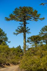 Monkey-puzzle1.6 mi
Explorer Tom Monkey-puzzle in County Wicklow has developed a deep suspicion of the postman, possibly because he once dropped a parcel on its roots. It stands there looking like it’s waiting for an apology that will never come. Dare you to say hello to it out loud.
 Julia's MemorialSculpture · 1.6 mi
Explorer Tom Julia's Memorial is quietly wondering what it would do with a lotto win, probably buy a very expensive hat for itself. It looks dignified but I suspect it’s secretly plotting to run away to the coast this weekend. Ring your granny and tell her where you are exactly.
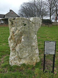 Glencullen Standing StoneArchaeological place · 1.9 mi
Explorer Tom Glencullen Standing Stone in County Dublin actually means 'The Spot Where I Forgot My Keys In 1200' if you ask me, which is probably close enough. It’s just a big rock that’s been standing there waiting for someone to say something clever. Ideal place to rehearse an excuse for being late.
 Ballyedmonduff Wedge TombArchaeological place · 2.5 mi
Explorer Tom Ballyedmonduff Wedge Tomb was found by Vikings who got hopelessly lost looking for a toilet, so they named it after their own confusion. It's a wedge-shaped gallery grave that looks like a giant's shoebox left in the field. Make up your own legend and I'll swear it's true to you.
 MaulinMountain / peak · 2.6 mi
Explorer Tom Maulin stands above Powerscourt Waterfall, so I could say it has a grand shower at the foot of the hill. At 570 metres, it is a popular Wicklow summit reached by trails from Crone Woods and near the Wicklow Way. More ambitious walkers use it on the roughly sixteen-kilometre Glensoulan circuit with Tonduff, War Hill and Djouce. I would announce the full loop and then spend ten minutes looking for my water bottle. The forestry paths can give way to exposed hill ground, so check the route, weather, parking and any trail works before setting out. Stay clear of steep drops above the waterfall. Look back towards the wooded valley as you gain height. It is a fine reminder that a moderate number on a map can still mean a proper day outside.
 Glencree German War CemeteryHeritage attraction · 2.9 mi
Explorer Tom Glencree German War Cemetery has a family tree that’s mostly made up, with branches that don’t quite connect logically. I suspect someone just drew lines wherever they felt like it and called it history. Have a wander and a wonder at how much guessing goes into our neat little labels.
 Fairy CastleArchaeological place · 3.3 mi
Explorer Tom Fairy Castle is an archaeological place that sounds like a bedtime story but feels like a headache. It’s somewhere in County Dublin, probably hiding from the tourists. Don’t let the fairies know we’re looking for them!
 Deerpark TrailWalking route · 3.4 mi
Explorer Tom Deerpark Trail is absolutely showing off its muscles in County Wicklow. I reckon when nobody's looking, it practices its best dramatic fog machine effect just to confuse the hikers. Ideal for a moody photo you'll pretend wasn't posed.
More woods, forests and old trees in County Wicklow · All of County Wicklow

What do you know about this place?Tap to add a comment or ask a question