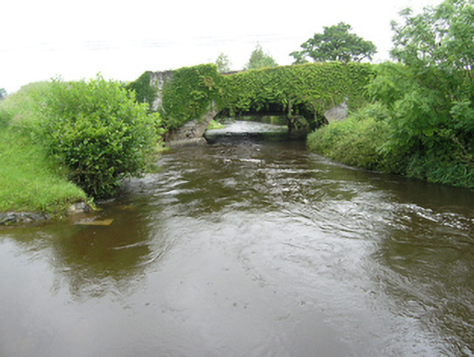
What is recorded here
Single-arched limestone road bridge over Larah River with humped deck, built c.1750, now bypassed. Elliptical arch with roughly cut sandstone voussoirs. Spandrels and parapet of random rubble limestone with Scotch coping. Flat-decked bridge of c.1955 against downstream elevation.
A good example of an eighteenth-century road bridge built entirely of rubble stone, of a type which is now quite rare. The narrow humped deck and manner of construction demonstrate the early date of the bridge. The bridge is a reminder to the older road system in this area, and is possibly part of the same road project as the nearby Rathkenny Bridge.
From the Buildings of Ireland (National Inventory of Architectural Heritage) record 40401630
This does not grant access. Most recorded buildings are privately owned; view them only from public ground unless the owner allows entry.
Places near here
Giant's GraveArchaeological place · 448 yd cottage ornee538 ydRathkenny BridgeBridge · 574 ydDernaskeaghMountain / peak · 1.2 miEmbanked enclosureBawn · 1.7 miBawn in DrumsheilBawn · 1.8 miGiant's GraveArchaeological place · 1.9 miCabragh RingfortArchaeological place · 3.4 miCormeen Glebe ForestForest · 4.3 miFin Mc Cools FingersStone row · 4.5 miFlagpole HillMountain / peak · 5.8 miEuropean Yew6.0 mi
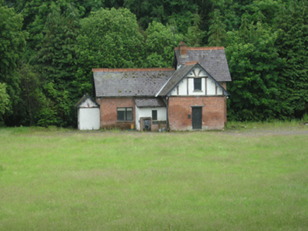 cottage ornee538 yd
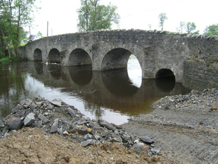 Rathkenny BridgeBridge · 574 ydDernaskeaghMountain / peak · 1.2 miEmbanked enclosureBawn · 1.7 miBawn in DrumsheilBawn · 1.8 miGiant's GraveArchaeological place · 1.9 mi
 Cabragh RingfortArchaeological place · 3.4 mi
 Cormeen Glebe ForestForest · 4.3 mi
 Fin Mc Cools FingersStone row · 4.5 mi
 Flagpole HillMountain / peak · 5.8 mi
 European Yew6.0 mi
Pictures: National Inventory of Architectural Heritage; Pamela Norrington, Wikimedia Commons · CC BY-SA 2.0; Eric Jones, Geograph · CC BY-SA 2.0; Deadstar, Wikimedia Commons · CC BY-SA 4.0; D Gore, Geograph · CC BY-SA 2.0; Sitomon, Wikimedia Commons · CC BY-SA 2.0
More historic places in County Cavan · All of County Cavan
What do you know about this place?